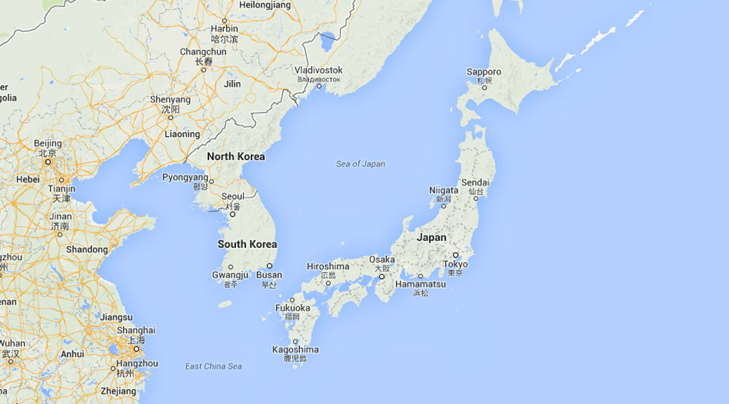
During our Australia trip, a conversation about perspective came up. Think about looking at a downtown cityscape. If you’re in the middle of the city, you see the individual streets and buildings. But if you’re 20 miles outside of town, the city becomes two-dimensional. The dozen blocks worth of buildings are now a single row of buildings.
Japan is about 142,000 square miles, similar in geographic size to Montana. From north to south, it’s roughly the northern border of Oregon to the southern border of California. But news from Japan in the U.S. flattens like the cityscape from a distance. We often get questions from friends and family as to how far away we are from natural disasters and crazy weather.
To help put our location in perspective, I prepared the following handy dandy chart showing our distance (as the crow flies) from major Japanese cities as well as a comparative distance from Portland to another U.S. city. I also added places like Sendai, which suffered major damage in the 2011 earthquake, and Ōkuma, home to the Fukushima Daiichi Nuclear Power Plant.
| City | Distance from Kawagoe |
U.S. City | Distance from Portland |
|---|---|---|---|
| Tokyo | 20 miles | Newberg, OR | 21 miles |
| Yokohama | 35 miles | McMinnville, OR | 34 miles |
| Mt. Hakone | 52 miles | Monmouth, OR | 54 miles |
| Mt. Ontake, Nagano | 112 miles | Redmond, OR | 113 miles |
| Ōkuma (Fukushima) | 132 miles | Kent, WA | 130 miles |
| Nagoya | 154 miles | Redmond, WA | 151 miles |
| Sendai | 179 miles | Kennewick, WA | 177 miles |
| Kyoto | 219 miles | Medford, OR | 221 miles |
| Osaka | 240 miles | White Rock, BC | 241 miles |
| Kōbe | 257 miles | Vancouver, BC | 259 miles |
| Iwate | 276 miles | Spokane, WA | 289 miles |
| Hiroshima | 412 miles | Chico, CA | 403 miles |
| Sapporo | 503 miles | Butte, MT | 490 miles |
| Mt. Aso, Kyushu | 523 miles | San Francisco | 536 miles |
| Fukuoka | 541 miles | Pocatello, ID | 539 miles |
| Okinawa | 968 miles | Mexicali, Baja MX | 972 miles |

