Staycation

The guardian at Naritasankawagoebetsuin Hongyoin Buddhist temple.

Japan has a lot to offer in terms of sightseeing. With Tokyo nearby, we’ve overlooked some of the local sights. We found ourselves with a couple free afternoons last week, so we took advantage to explore Kawagoe and the area surrounding our neighborhood a little more.

Neighboring Tsurugashima is a couple miles from our apartment. It’s a scenic walk when we cut through Oisezuka Park.
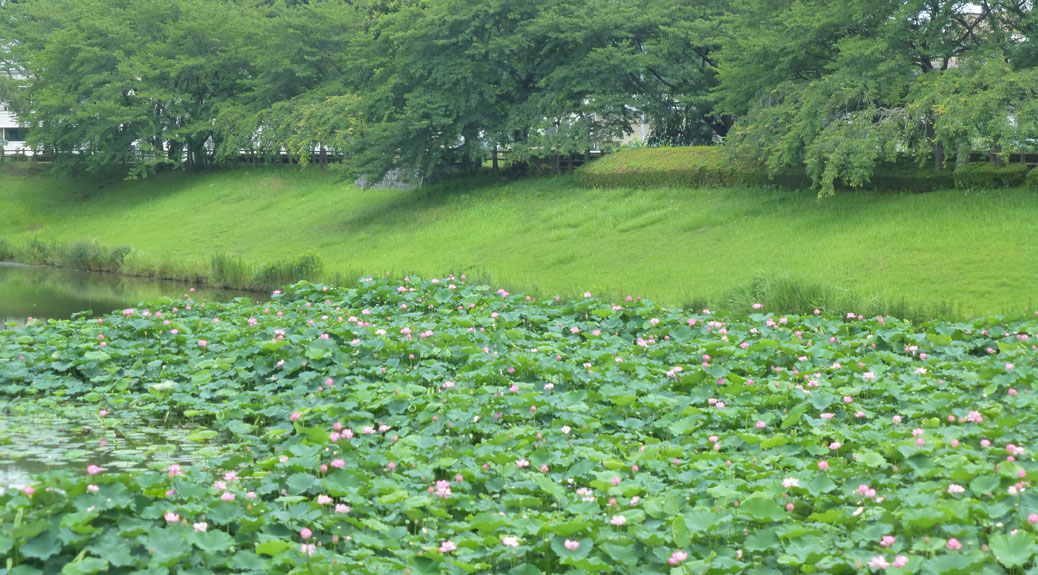
Lotus
Lotus flowers grow from the pond near Oisezuka Park.

The lotus flowers are starting to bloom. They grow out of the shallow ponds around the park. There’s a walking path with benches around this pond, which makes it a great place for a relaxing walk or to sit and listen to a local plucking away on her shamisen.
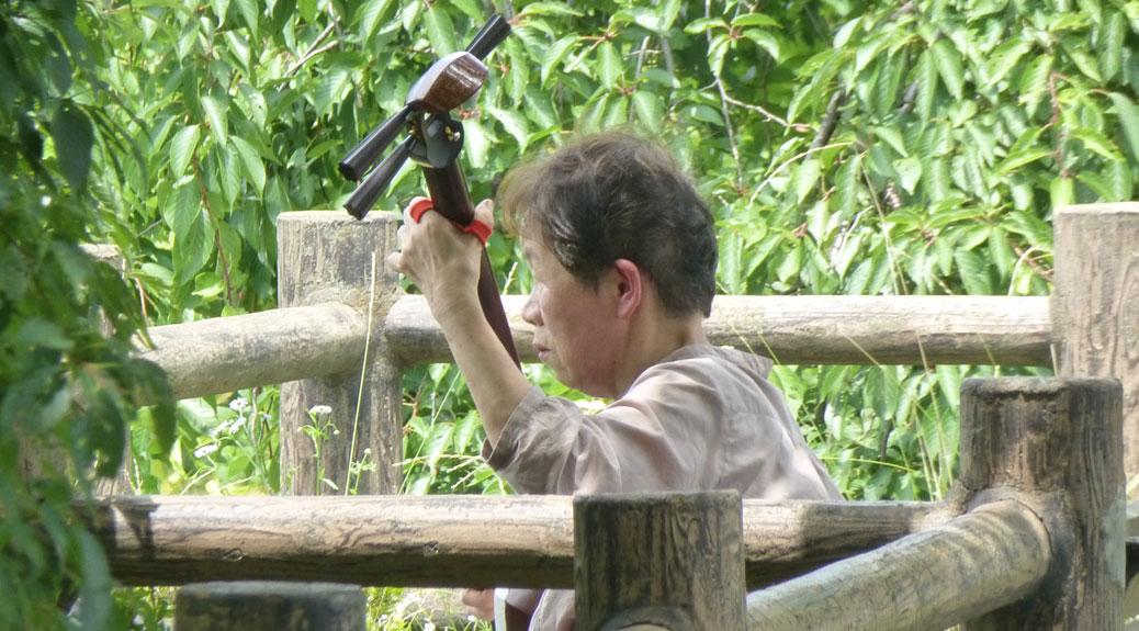
Shamisen
This woman was playing the shamisen, a three-stringed instrument similar to a guitar.

This side of the Iruma River (入間川) is home for many local farmers. The rice paddy fields stretch the length of the river. It’s also home to a lot of wildlife, including a family of ducks who worked their way up and down the rows.
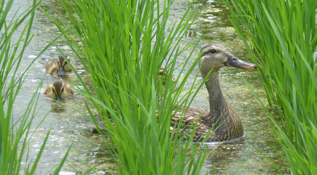
Ducks
This mama had three little ducklings following her through the rice paddy field.

We originally headed for Wood Bakers Pizza in Tsurugashima, but the restaurant was closed unexpectedly. We found some really great Indian food nearby with naan larger than my head.
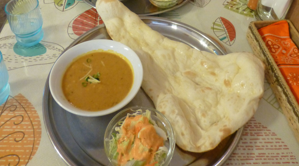
Naan
Head-sized naan at New Darjeeling Indian Restaurant

A few days later we headed into central Kawagoe and the Koedo (or “Little Edo”) area. Edo was the name of Tokyo until the mid-1800s. This is the historic part of Kawagoe. But, first… pizza! The pizza shop in Tsurugashima also has a location in Koedo and it was open!
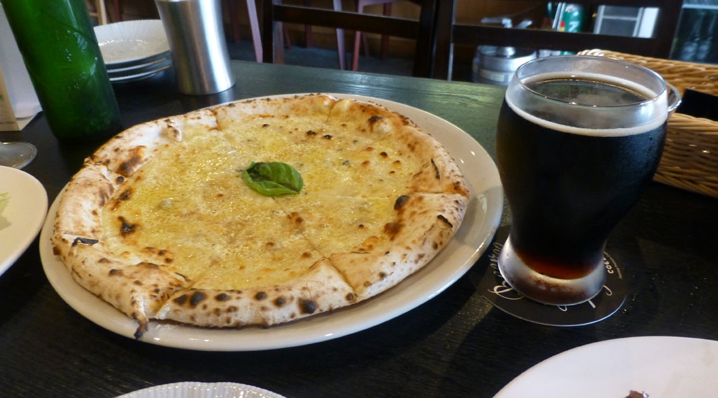
Pizza
Margherita pizza and a Shikkoku from Kawagoe’s own Coedo Brewery

It was a little after lunch, so we were the only customers in the place. The pizza is cooked in a pellet-fired oven using Traeger pellets from Mt. Angel, OR and Strawberry Mountain pellets from John Day, OR. They framed the bags and hung them on the wall as decor.
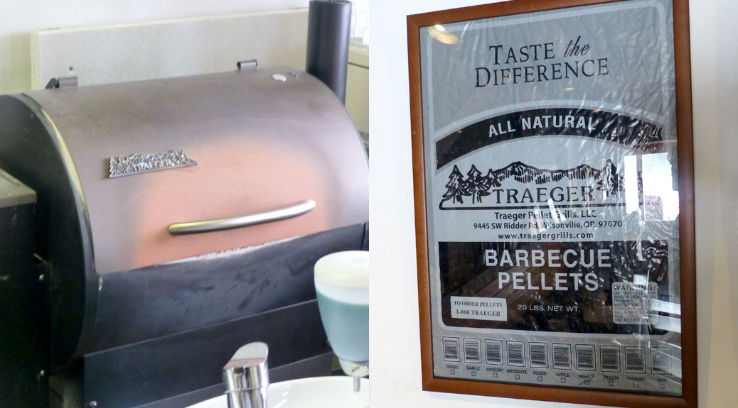
Traeger pellets
The Traeger grill and pellet bag at Wood Bakers Pizza in Koedo.

The staff was laughing a bit when I started snapping pictures of the pellet bags on the wall, but when I explained Watashi wa Oregon kara desu or I’m from Oregon! they got pretty excited. They pulled pellets out of the bag for me to smell and showed me their Traeger grill in the shop. We sounded out Ponderosa Pine together. Great pizza and more new friends!

Stomachs full, we headed for Kita-in, a Buddhist temple originally founded in 830. The temple burnt down in 1202 and again in 1638. Because of the site’s importance to the Tokugawa shogunate, following the 1638 fire, several structures from Edo Castle were transferred here. Since Edo Castle was destroyed by fire in the Great Kanto Earthquake of 1923, the structures at Kita-in are the only remaining structures from the original Edo Castle.
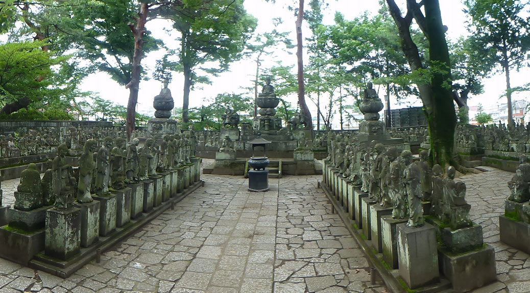
Gohyaku Rakan
Gohyaku Rakan, or 500 disciples of Buddha.

One of the highlights of Kita-in is the Gohyaku Rakan, or the 500 disciples of Buddha. There are 540 hand-carved statues that are so unique in design that no two are alike. The local legend says that if you feel each of the statues in the dead of night, one will feel warm to you. When you return during daylight, you’ll find that the statue resembles you. Since the statues were gated off during the middle of the day, I’ll have to assume the legend is accurate.
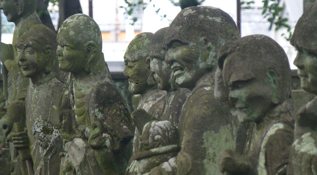
Gohyaku Rakan
Closeup of a few of the Rakan at Kita-in

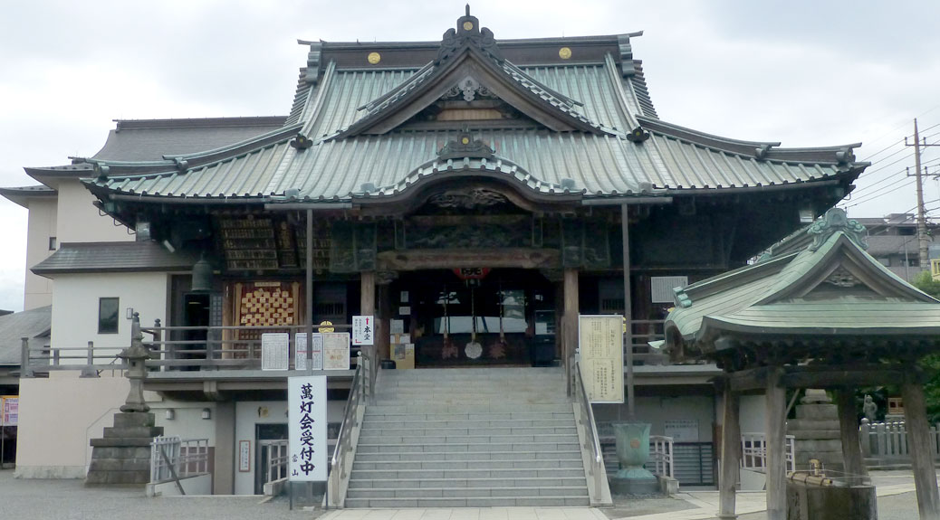
Along the way, we passed Naritasankawagoebetsuin Hongyoin Buddhist temple. We were drawn in by the rhythmic pounding of Taiko drums and haunting Buddhist chants. In addition to the shrines, there were also great statues, including the gate protector who didn’t look like someone you’d want to run into in a dark alley.
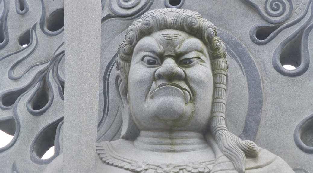
Guard
The guardian at Naritasankawagoebetsuin Hongyoin Buddhist temple.

Kawagoe has several more sights to see, but since they’re spread across town and we were racing the rain, we decided to save them for another day.
Lost in Japan… Again

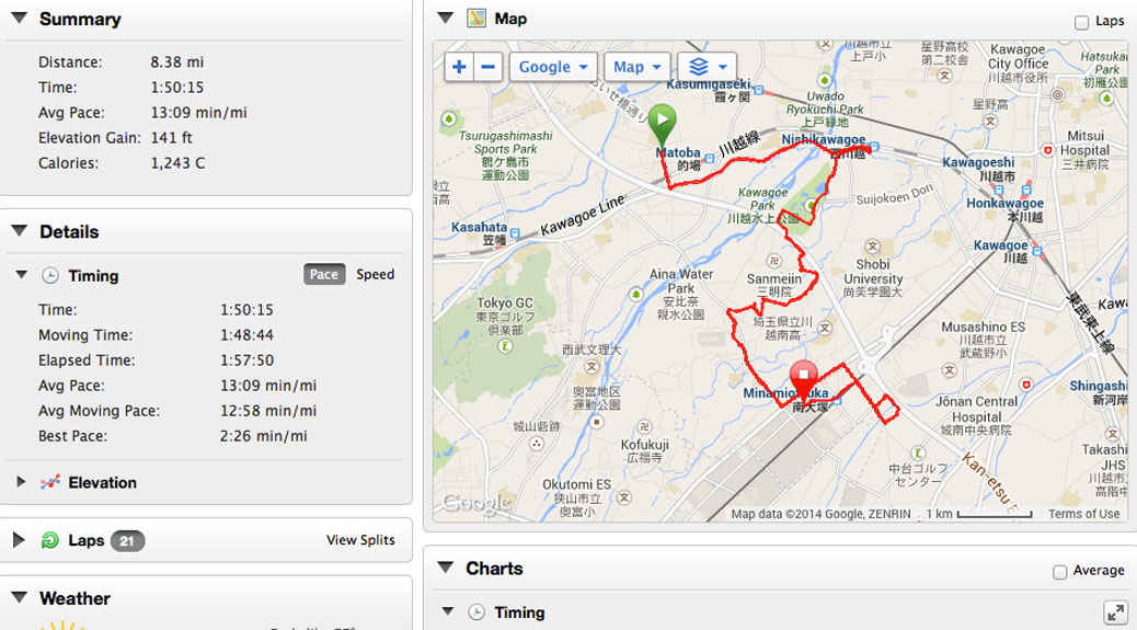
Garmin Map

When I set out for my runs, I always have the same plan. Go halfway, turn around, go home. I’ve yet to actually do this. I always try to take a different route, and when I reach the halfway point, I see something that looks interesting and check it out. I usually add a mile of walking to my run as a result.

Yesterday, I set out for my run early on a 77 degree morning. I had a general route in mind for a 45 minute (roughly four miles) run. I turned on my Garmin GPS running watch and was on my way. But it happened again…

I did manage to turn around at the halfway point, but as I crossed the street, I discovered the narrow bridge in the road didn’t have a sidewalk. Instead of dodging traffic, I headed down a side street parallel to the bridge. I was looking for the river path, which I found, but it also led me into Kawagoe Park, where I hadn’t been yet.

It’s a fantastic park, complete with a pond and the ever-present swan boat rentals, tennis courts and a great running path with some shade. I followed the path for a bit until I came to the river path which would take me home. Here’s where it all went wrong.

I’ve decided that my navigation issues in Japan are due to the fact that none of the streets are straight. In the U.S., you can typically follow a street, pop up a block and still be running parallel to the previous street. In Japan, streets curve without reason and if your attention wanders for even a second, it’s all over.

As I approached the river path, I saw that the running path ran alongside it under some nice, shady trees. I stayed in the shade and then crossed the road to head for home. Apparently I got turned around, because instead of heading north for home, I was heading south.

Kawagoe’s a decent-sized city, but I saw enough potential landmarks that I thought I was still heading in the right direction. After about five miles though, I hadn’t seen the landmarks I was expecting. I did, however, see a giant battleship, a DeLorean (Back to the Future car!) on a roof and an oversized fiberglass chimpanzee in blue overalls.

I stopped in a 7-11, bought a water with my last 100 yen and asked for directions.

Matoba-eki wa doko desu ka? Where is Matoba Train Station?

The clerk drew me a map on the back of my receipt, indicating the station was just up the road a bit. I headed in that direction, his map perfectly guiding me… to Minamiotsuka Station on the south side of Kawagoe.

One thing I’ve come to learn about the Japanese is that they will give incorrect information before they come off as being unhelpful. The clerk basically gave me directions to the nearest train station, which sent me another mile in the wrong direction.

Things only got worse as I saw a sign for Belc Grocery Store, one of the landmarks I was seeking. I headed toward that, which is sort of like heading toward a Safeway in the states… there’s probably half-a-dozen Belc stores in Kawagoe. Finally, I came across a lady with a small produce stand. Huffing and puffing, I asked again… Matoba-eki wa doko desu ka? 

She gave me a sort of pathetic look and said, what I gathered to be, you’re nowhere near Matoba Station. Totemo tooi desu ka? I asked while pulling distance between my hands in case my Japanese was faulty. She nodded yes with something between pity and empathy.

I usually don’t mind getting lost on my runs. I know I can’t get too far from home on foot and will eventually find my way, but for the first time, I was nervous. I had no clue where I was and knew that every step was likely taking me further from home. We had an appointment in Tokyo later in the day and I needed to be home. Usually I throw 1,000 yen in my pocket, just in case, but I didn’t have any money with me. About seven miles into my run, I alternated sprinting and walking back toward the main street.

That’s when my rescue plan came together. When we first arrived in Kawagoe, we took a taxi to our hotel. The driver lets you in, takes you to your destination, then collects payment. I headed back toward Minamiotsuka Station, where I hoped to find a taxi stand. Sure enough, two taxis had just pulled in and I flagged one of them down.

I gave the driver my address, he wrote it down to verify and we were on our way. I got a chance to try out a new phrase I’d just learned.

Nihongo ga chotto wakarimasu… I paused as I found the next words… demo ganbarimasu! The driver chuckled, my comedic timing translating to Japanese.

I only understand a little Japanese… but I try my best!

I guess the same can be said for my navigation skills. I made it home, safe and sound, and ran upstairs to grab my wallet. I was so far away from home that it cost 1,900 yen (about $19 USD) for the taxi ride. Best 1,900 yen I’ve ever spent.

In all, my 45-minute, four mile run became a one hour and 50 minute, 8.25 mile trek. My favorite part of the Garmin mapping of the run is the end. I’d left the watch on for a minute in the car, so the last split is a two-minute mile as we sped toward home.