Petra: Secrets of the Lost City

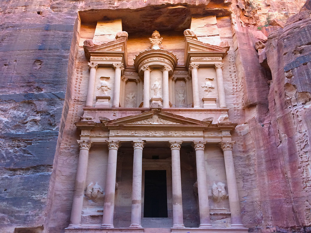
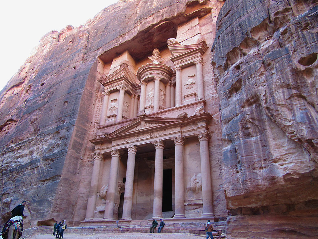
The Treasury is Petra's most iconic building. Thanks to a restoration project in the 1960s, it's also one of the best examples of Petra's prime.

Westerners have a long tradition of discovering things that were never lost in the first place. The ancient city of Petra, hidden away in Jordan’s southwestern desert, was “discovered” by Swiss explorer Johann Ludwig Burckhardt in 1812. However, the Rose City—named for the color of the sandstone in late afternoon—had long been an object of curiosity in the region.

Today, Petra is one of the New Seven Wonders of the World (check out our rundown of the Seven Wonders we’ve visited) and Jordan’s most popular tourist destination. But 2,000 years ago, it was the capital city for the nomadic Nabataean people. They lived in caves chiseled deep into the sandstone and carved intricate facades into the outer walls to indicate temples and tombs.

After driving from Amman the night before, we started our visit early to beat the rush of tourists. Upon entering Petra, signs of ancient life are immediately visible. Shapes in the sandstone are easily identified as man-made, despite nature’s attempts at reclamation.

"<yoastmark

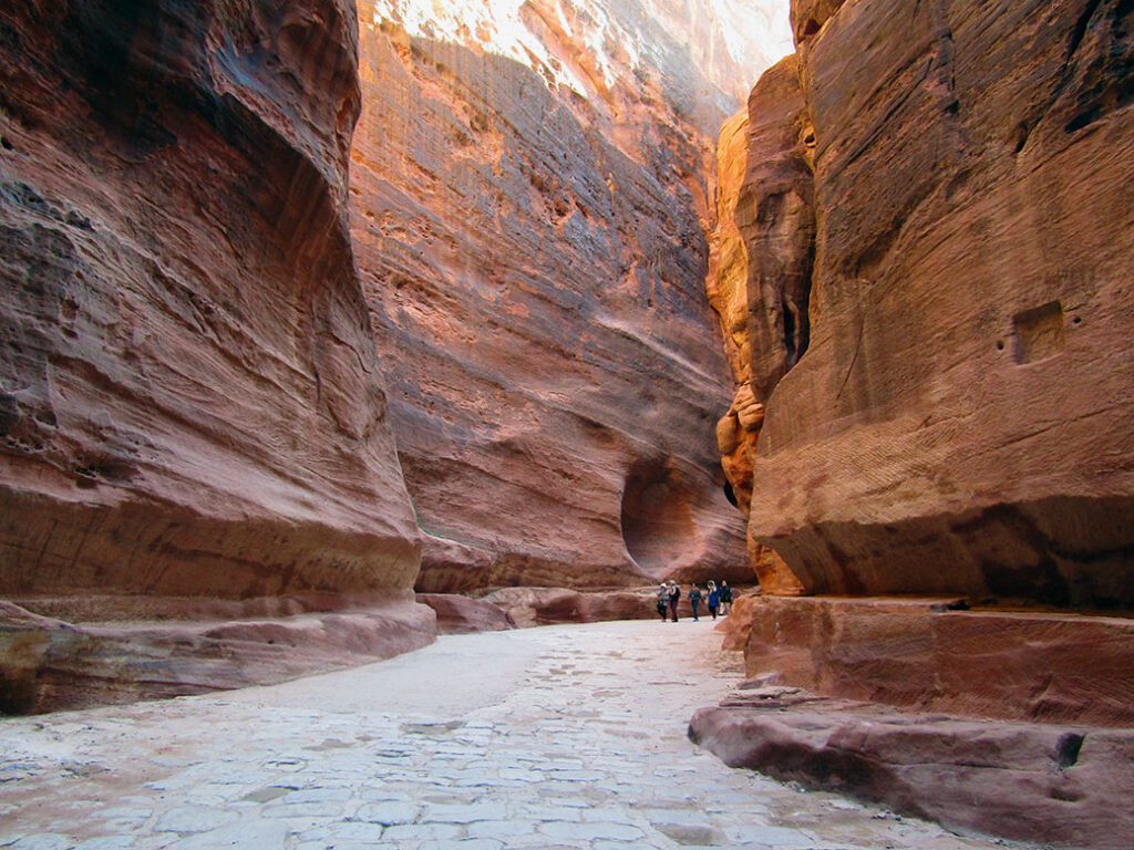
Before long, we arrived at a crack in the earth. The Siq, a natural passageway formed by a prehistoric earthquake, is as narrow as 10 feet wide and as tall as 600 feet. The sandstone canyon stretches more than a kilometer. It’s a walk through natural history with millions of years of layered sediment painting the walls. As the sun moves through the sky, the colors change from gold to rose.

In stretches, we also walked atop human history. Cobblestone roads installed by the Roman Empire during the 1st century AD are still visible. Remnants of 2,000 year old clay irrigation pipes line the sides of the wall, once providing water to the city.

The Treasury
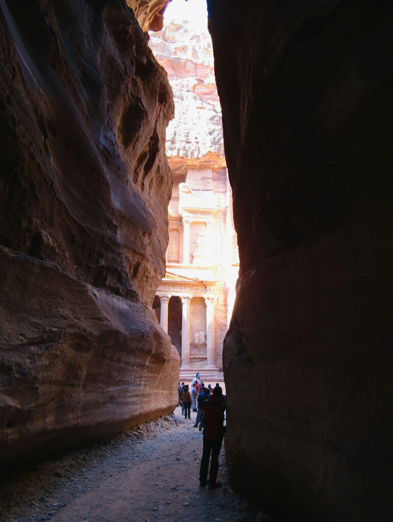
At the end of the Siq, we get our first glimpse of The Treasury.

As we approached the end of the Siq, we caught our first view of the main event. Al-Khazneh—better known as The Treasury—is Petra’s most famous building. Carved around the same time as the arrival of the Romans, its architecture is a mix of Nabataean and Greek Hellenistic influences. It began life as a mausoleum, but earned its nickname due to a local legend that the urn carved above the second floor contained gold. Bullet holes are still visible where local Bedouin tribes tried to shoot the gold free from its perch.
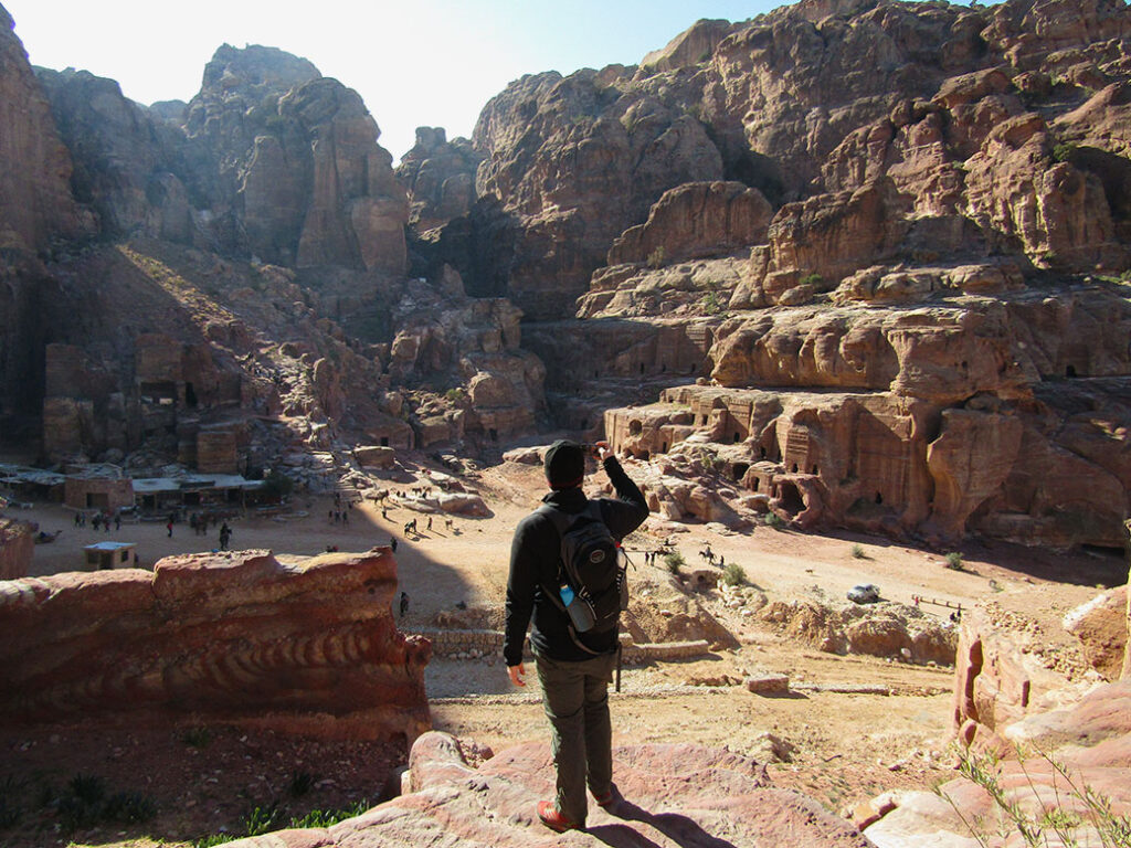
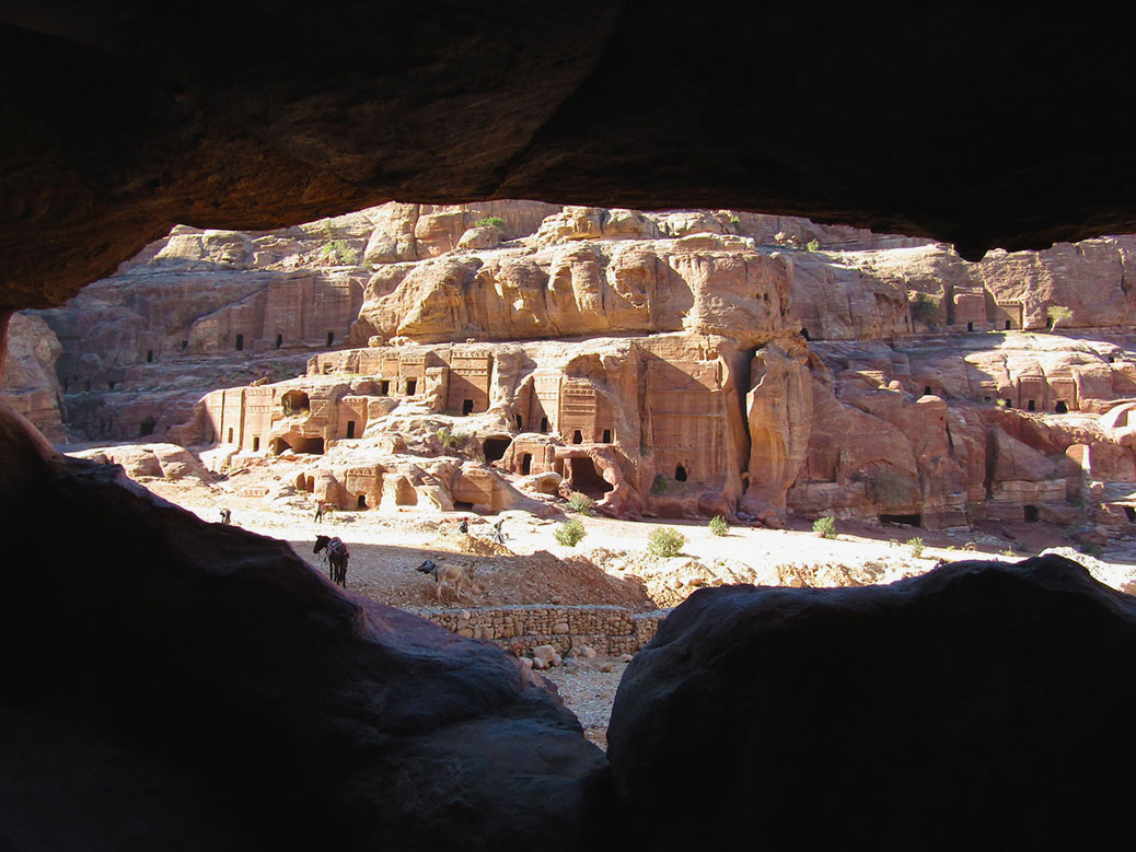
Looking down at the Street of Facades from the side of Al Kubtha Mountain.

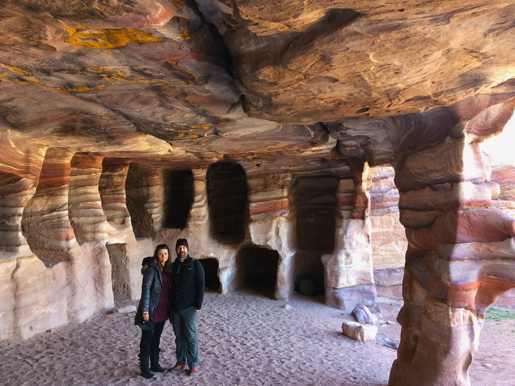
Continuing from the Treasury, we found ourselves entering the Street of Facades. The street is marked with tombs and false fronts framed by ornate facades. Instead of following the tour groups into the old city center, our fantastic local guide led us against the side of Al Kubtha Mountain. From here, we could peer into former tombs of the local people. Not unlike the carved caves that housed them, tombs were dug into the floors and walls.
"<yoastmark

The caves are the best place to get up close and personal with the history of Petra. Wall carvings from the people who have lived here over the past two millennia are still visible. We marveled at the natural artwork created by the layers of wind-swirled sand. Spectrums of reds, yellows, purples and earthtones provided decoration for living quarters and final resting places alike.

The Royal Tombs

"The

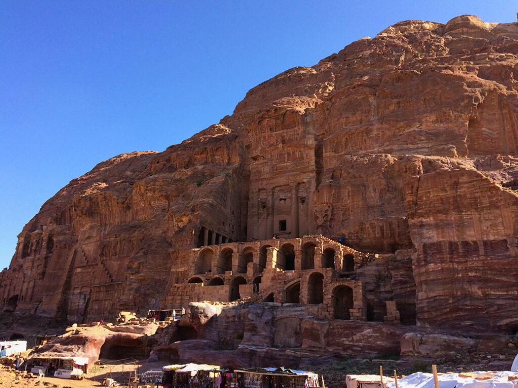
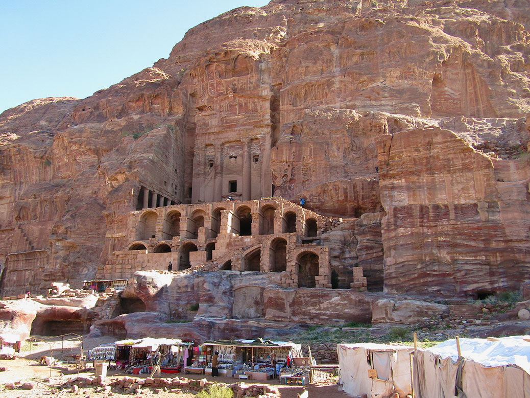
Our guide led us around the corner where we came upon another set of buildings. Four Royal Tombs wrap around the northeastern end of Al Kubtha Mountain. The first is the Urn Tomb. With more depth than the previous facades, it was built for a Nabataean king—either Aretas IV or Malichus II—in the 1st century AD. Inside, inscriptions and asps designate the tomb’s conversion to a Catholic cathedral in the 5th century.

"<yoastmark

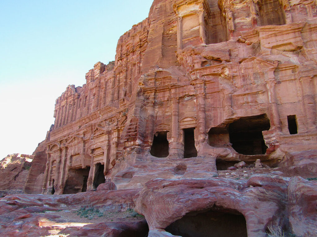
Nearby, the Silk Tomb, named for its richly-colored facade, slowly fades back into the sandstone. The neighboring Corinthian Tomb provides another example of Roman architectural influence with its embellished column design. The Palace Tomb sits attached, three-stories tall with a large stage in front. It’s facade is inspired by the Golden House of Nero in Rome.

Top of the World
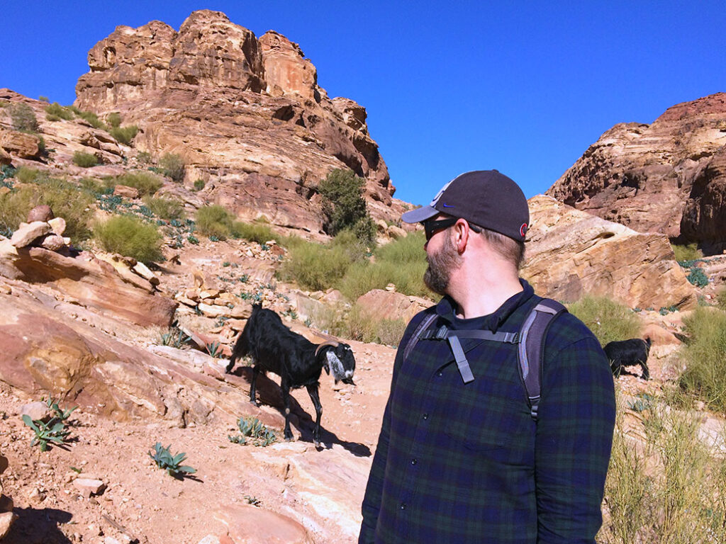
We encountered a herd of mountain goats near the top of Al Kubtha Mountain.

Our guide left us at this point with rough directions to the top of Al Kubtha Mountain. We climbed the long sandstone staircase to the top where we encountered a herd of mountain goats. With one eye on the goats, we made our way to the edge of the mountain where a Bedouin-style tent appeared.
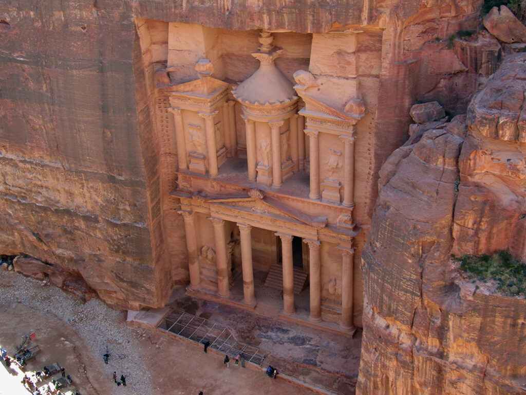
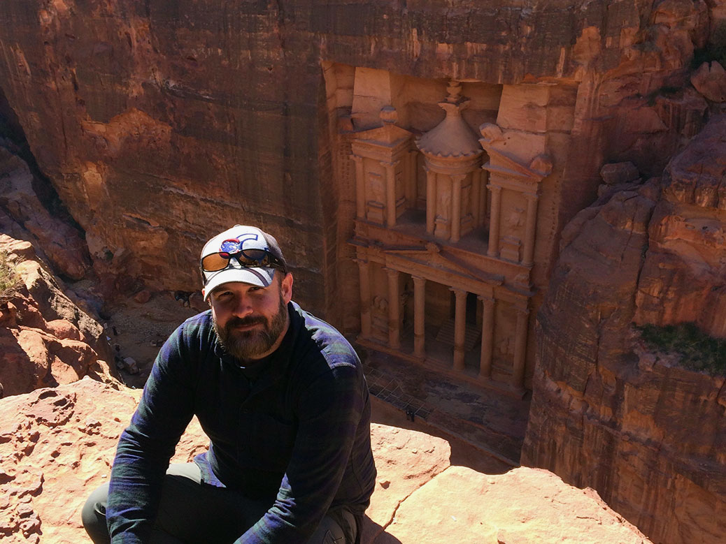
Looking down at the Treasury from the High Place on Al Kubtha Mountain.

Inside, a man named Salem offered free views of the Treasury and reasonably-priced refreshments. We sat on the edge of the stone, our feet dangling over the ledge, and enjoyed a Coca-Cola. Salem played a song on his traditional shepherd’s flute, served as official photographer and defied death while jumping between the levels of rocks along the sheer cliff.

The People of Petra
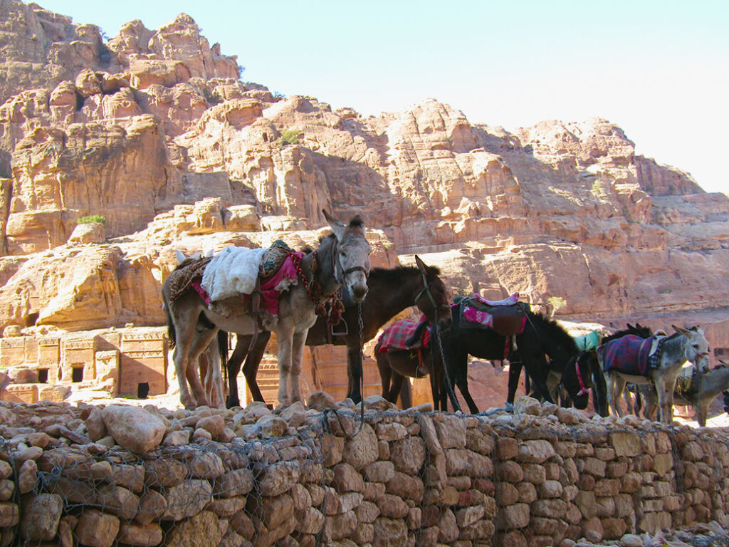
The real workers at Petra, donkeys and mules take a break in the shade near the Street of Facades.

We began the descent back down the mountain, turning down the various offers of assistance from donkey wranglers. For the past two centuries, the nomadic B’doul tribe has called Petra home. Descendants of the Nabataean, the B’doul lived in Petra’s caves and—since the 1920s—made their living by selling goods, services and charisma to tourists.
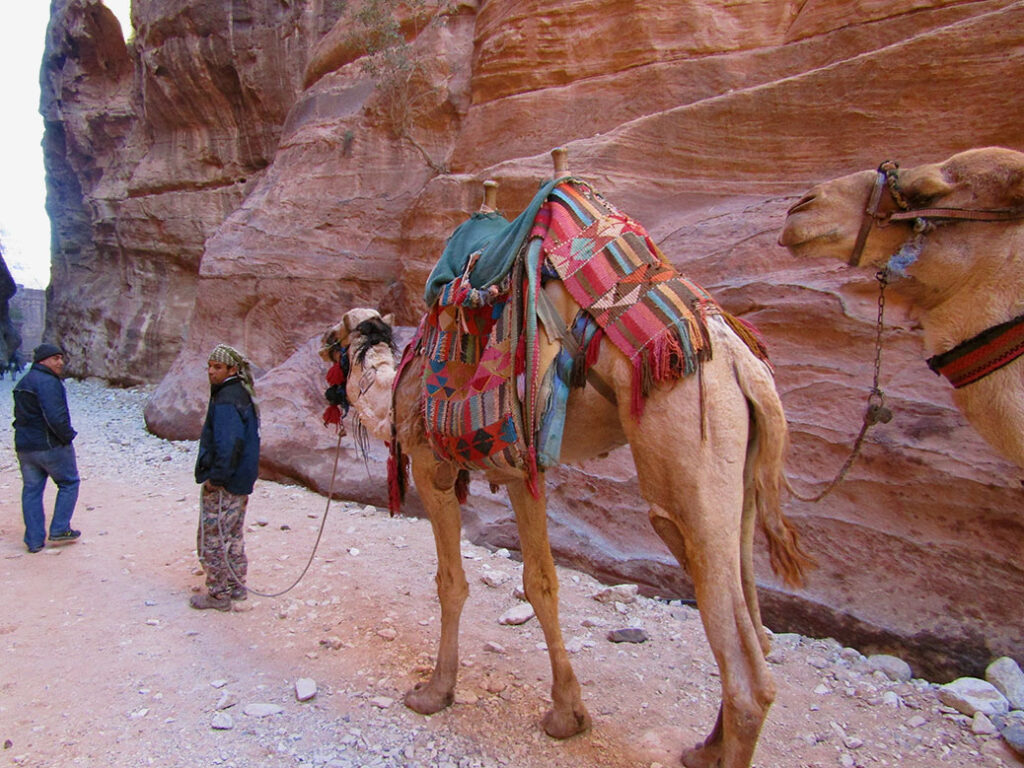
The local B'doul tribe make their living selling souvenirs and offering donkey or camel rides inside Petra.
The local B’doul tribe make their living selling souvenirs and offering donkey or camel rides inside Petra.

In 1985, UNESCO named the landmark a World Heritage Site. In an effort to keep the tribe from disturbing the newly-arriving tourists, the Jordanian government relocated the B’doul to a planned community in the nearby hills overlooking Petra. Three decades later, the neighborhood is overcrowded and underserviced, yet few B’doul want to leave their ancestral home behind. Even today, many serve as watchmen, keeping an eye over Petra throughout the night.

"<yoastmark

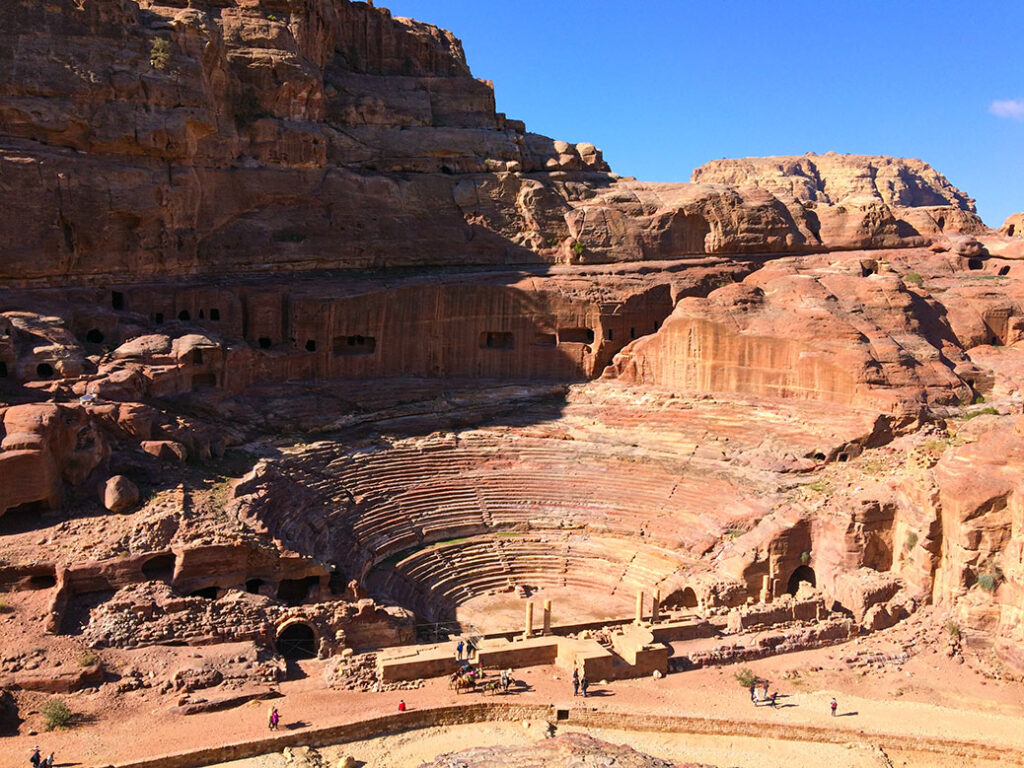
Petra is a rare glimpse into the daily life of an ancient culture. From the amphitheater in the city center to the Roman Colonnade Street, history comes to life in this place. A 5th century Byzantine Church, discovered under the sand in the early 1990s, shows that Petra was still a lively civilization long after most historians thought it deserted.

Today, 85 percent of Petra still waits to be uncovered. What other secrets exist below the desert sand?
How Many Wonders Have We Wandered?
New Seven Wonders of the World

Our recent two-week journey was through Cairo, Aswan and Luxor in Egypt as well as Amman, the Red Sea and Petra in Jordan. We realized that we saw two of the New Seven Wonders of the World on this trip, the Great Pyramids of Giza and Petra.

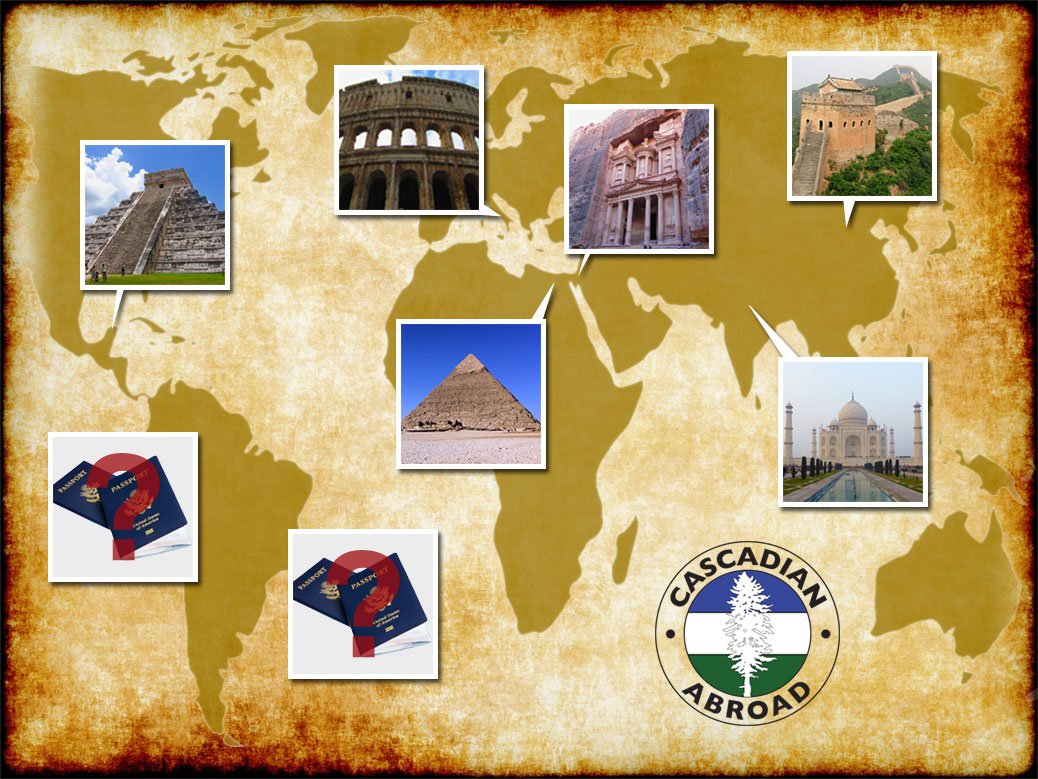
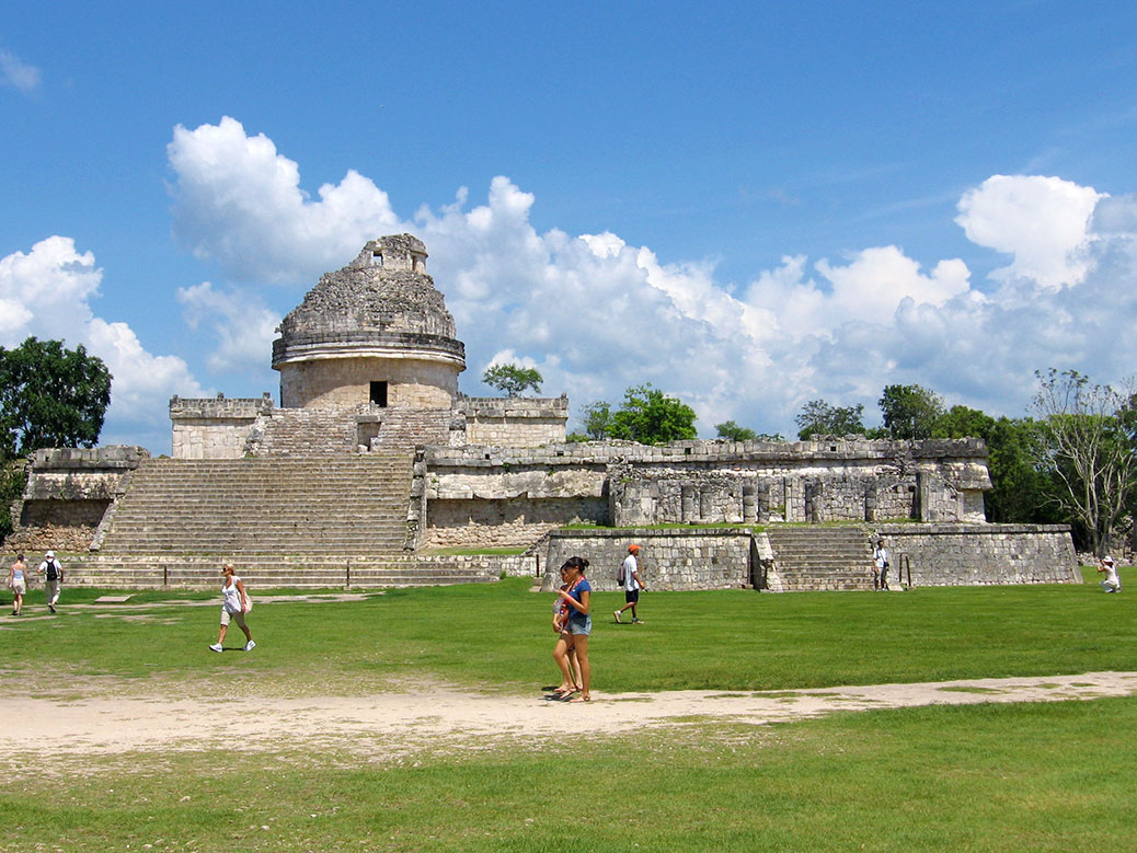
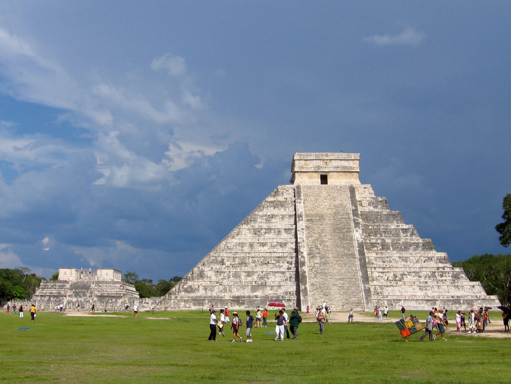
So far, we have seen five of the New7Wonders and six of the eight on the list total. The Great Pyramids have additional, honorary status on the list because they are an original (ancient) world wonder. Highlighted below are the Taj Mahal, Petra, the Great Wall of China, the Great Pyramids of Giza, the Colosseum and Chichen Itza.

The two wonders left on our list are Machu Picchu in Peru and Christ the Redeemer statue in Brazil. South America, here we come!

I admit I didn’t know much about the list of world wonders or really what or where they were. Most of these we stumbled upon in our journeys. In 2000, there was a worldwide voting of what the new seven wonders should be. These seven destinations emerged. There was a total of 20 finalists from all over the world. I’ll link the other finalists we’ve visited at the end of this article.

Do I think the six that we have seen so far should have made the cut? YES! It’s easy to think, ‘There’s a lot of hype. Will this place really be that great?’ All of the destinations are breathtaking, remarkable and worth the crowds and entrance fees and airfare.
Taj Mahal
Agra, India—February 2015

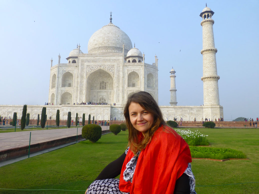
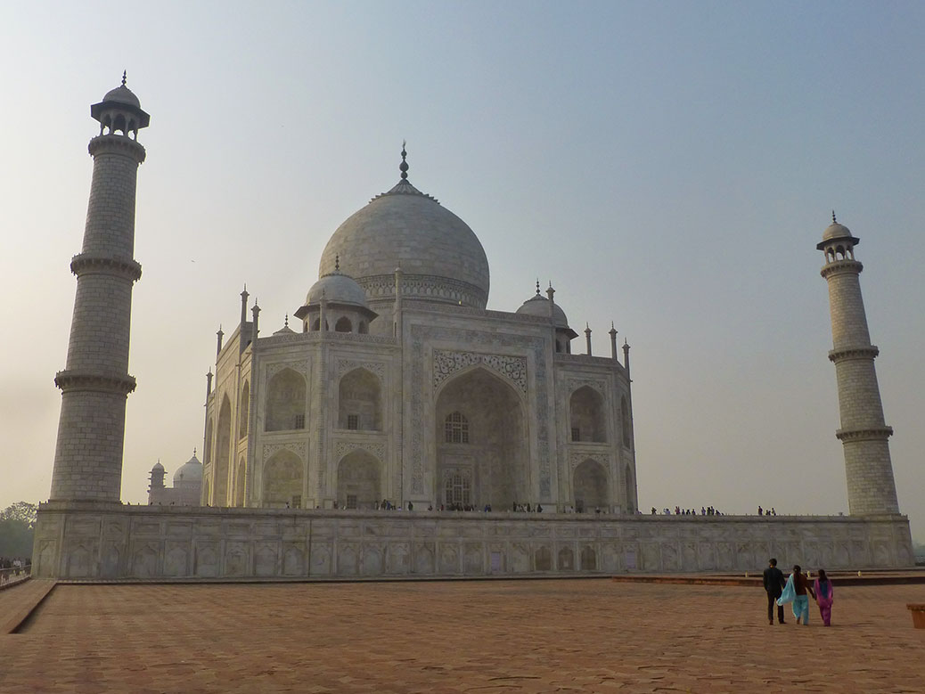
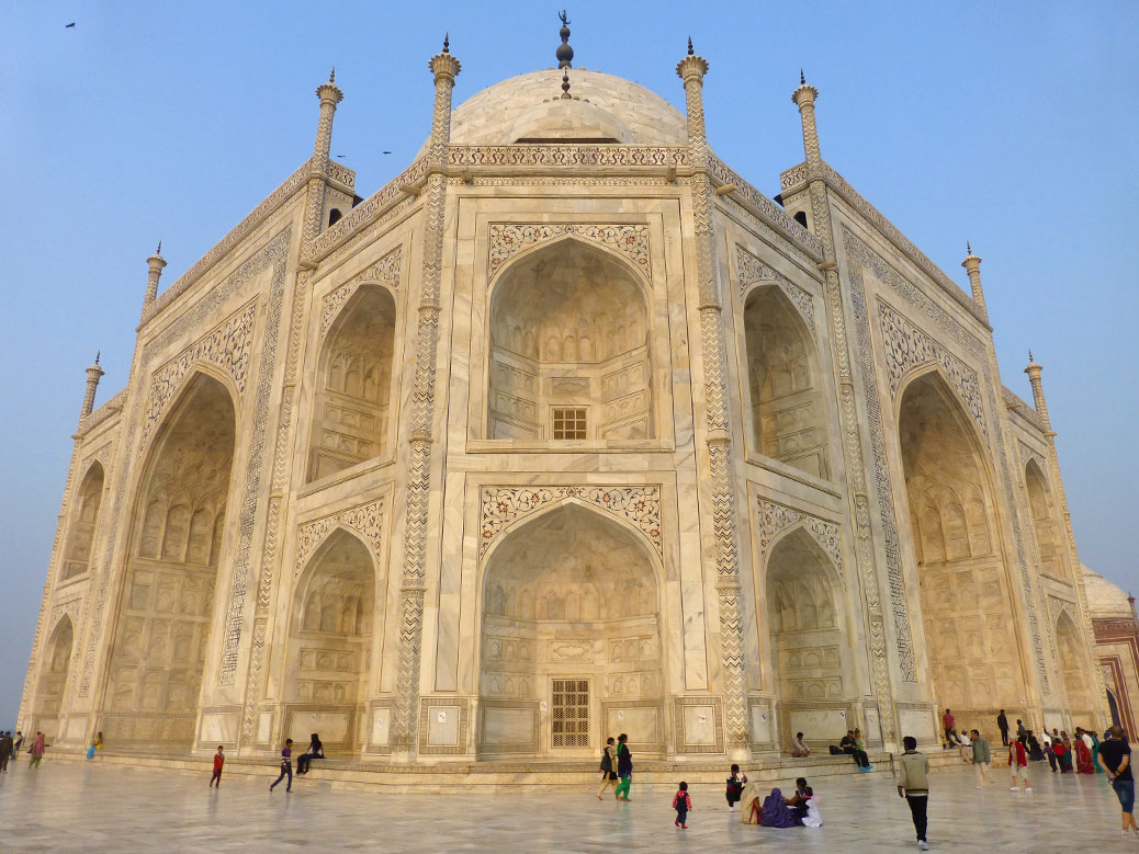
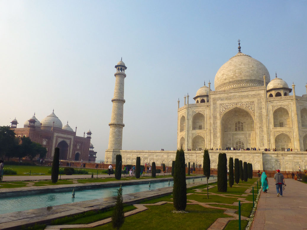
We visited the Taj Mahal in Agra, India on our six-week trip through India, Nepal and Thailand. It’s undoubtedly MY favorite world wonder. The first glimpse of the Taj made my heart drop. Taj day was the best day in India. Although we were surrounded by many Indian and some foreign travelers, we didn’t feel rushed or crowded.

We took our time wandering the grounds and watching the sun set on one of the benches. We even met another couple from Portland, Oregon on the bench next to us! As the sun set, the site was near empty and we were one of the last to leave that evening.


Petra
Petra, Jordan—January 2017

We added Jordan to our itinerary for Robert’s visit to Egypt. I was also interested in Istanbul, Turkey or Marrakesh, Morocco, but I think we made the right choice and those are still on my list! Petra is an incredible complex of tombs and temples carved from rose-colored sandstone. The town where Petra is located is named Wadi Musa, or the Valley of Moses.

The Treasury is the famous image from Petra and was featured in “Indiana Jones and the Last Crusade.” We climbed a facing mountain for a fantastic view of the Treasury from above. There was a small cave where we stopped to rest and drink a Coke. The day’s step count was more than 26,000! We had very sore feet the next day, but it was worth it.


Great Wall of China
Jinshanling, China—August 2015

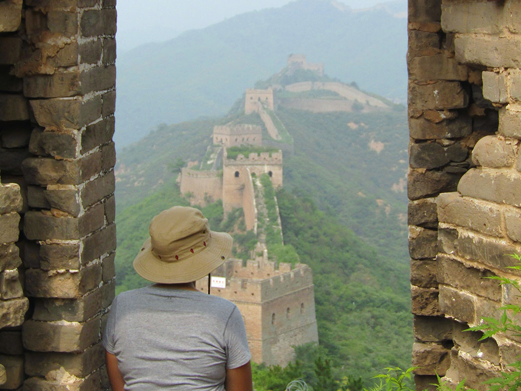
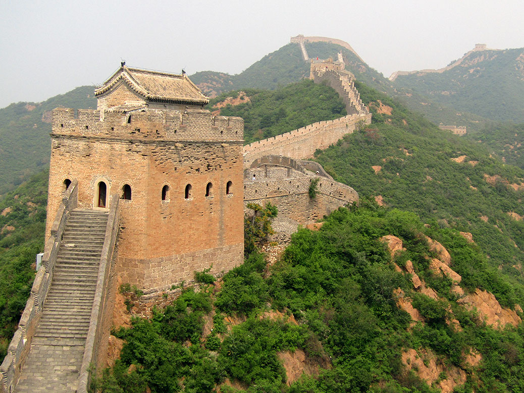
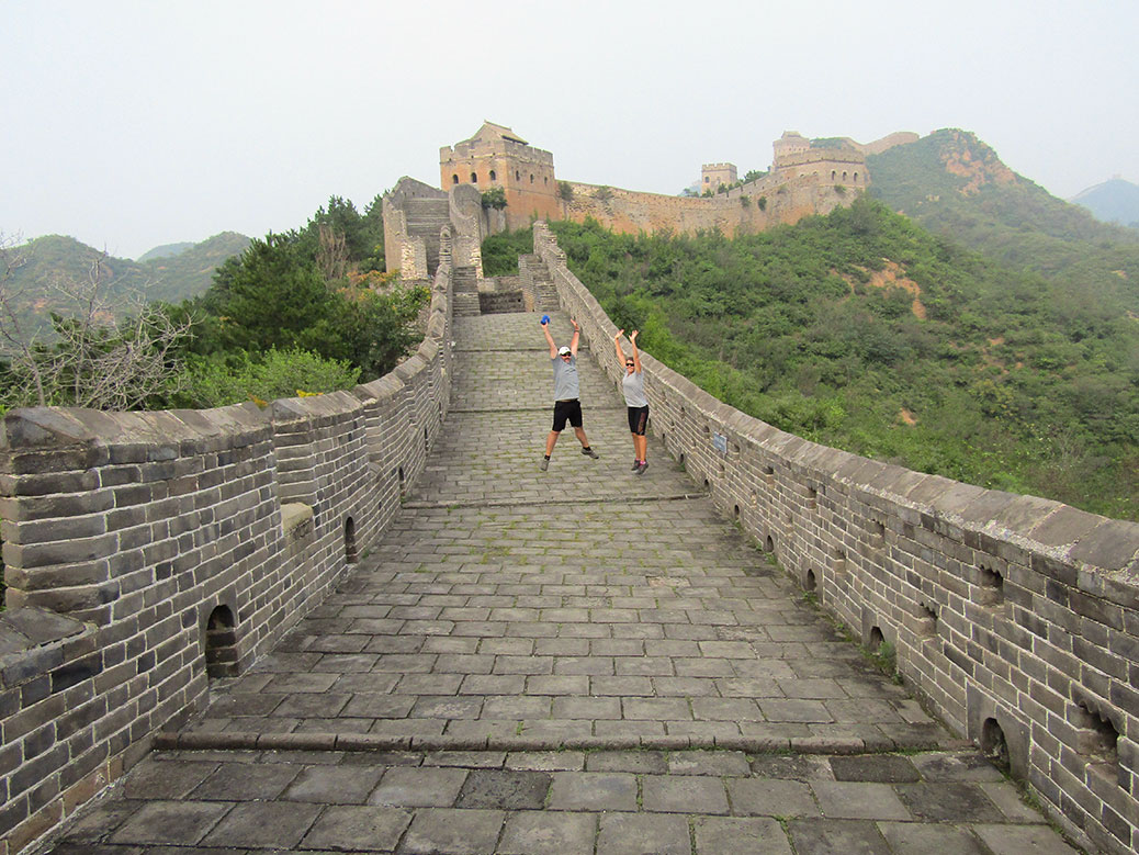
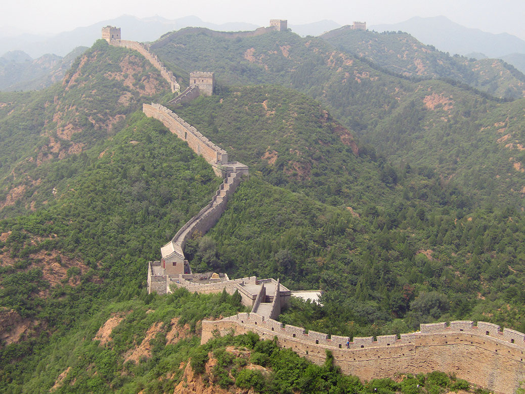
We saw the Great Wall on a six-week trip to Taiwan, China, Hong Kong and Vietnam. Similar to the Taj Mahal, the day at the Great Wall was my favorite day in China. Though Robert might argue that the Terra Cotta soldiers day was the best.

To me, the experience at the Great Wall was similar to Petra, because it was physically taxing. We walked up, down and around crumbling parts of the wall with little shelter from direct sun or humidity. And climbing without any supports or handholds also challenged my fear of heights. But, again (are you sensing a theme here?) it was worth it. The Tsingtao beer I had afterward was one of the most memorable beers I’ve ever had.


Great Pyramids of Giza
Giza, Egypt—December 2016

Although I’d been living in Cairo since August and had caught glimpses of the Pyramids from my school and the highway, I was glad I waited to enter the actual pyramid complex and see them close up until Robert’s visit. It was such a special experience that we can now share (see Robert’s blog post). Independent travel definitely has its merits, but I learned from my solo time in Egypt that travel is best with the one you love. We saw the Pyramids early in the morning with few crowds.

It’s unfortunate that the political landscape has affected tourism in Egypt and surrounding countries. Another Oregonian couple we met during our trip to Aswan and Luxor told us that their itinerary consisted of Morocco, Egypt and Paris. Of those three, their family was most concerned with Paris! Although we laughed about it, we totally agree! The atmosphere when we were in Paris in 2016 and surrounding areas like Brussels weeks before its airport bombing was more tense than any other travel we’ve done. But that doesn’t stop people from going to Europe and it shouldn’t deter people from traveling throughout Morocco, Egypt, Jordan, etc.


Colosseum
Rome, Italy—February 2016

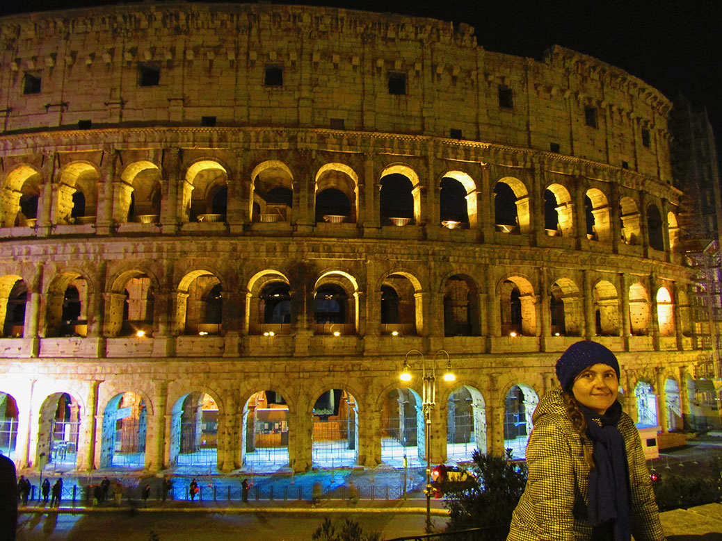
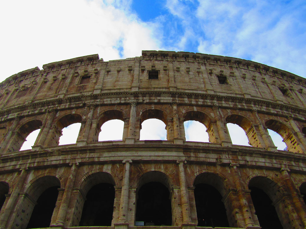
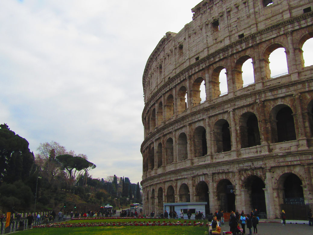
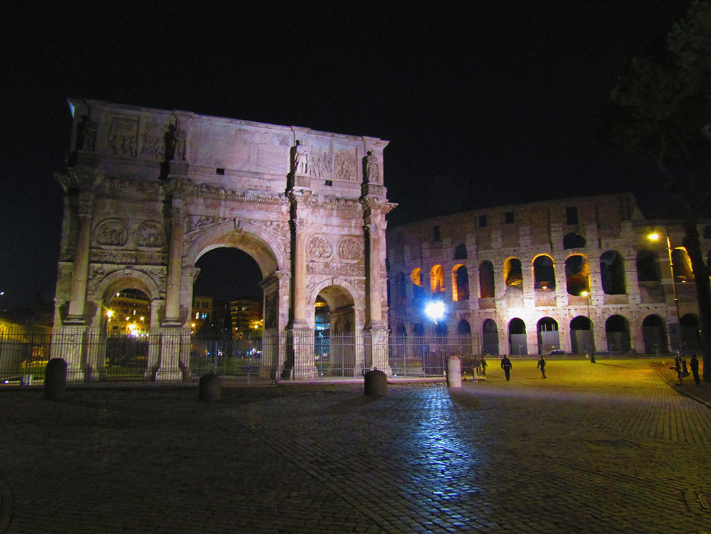
Speaking of our trip through Europe, I could wax poetic about Rome, Italy all day. We started the weeks long trip in Rome and we came back to Rome at the end of it as well. Our first day, we made sure our explorations on foot included the Colosseum. It was dark by the time we got there, but it added to the sense of wonder. What I love most about Rome is that, while it is now a very modern city, it is very easy to imagine how it could have appeared during ancient days (see Day 4 Ancient Rome). All of the wonders, including this amphitheater, have incredible stories locked forever in their foundations.


Chichen Itza
Yucatan, Mexico—July 2008

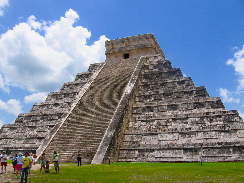
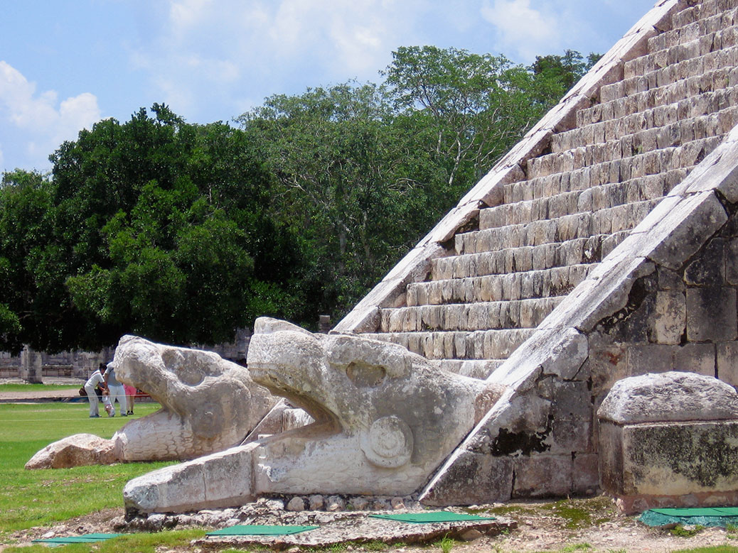
Chichen Itza was our first world wonder and one of our first trips abroad together after we married in 2007. Mexico is our first travel love; we’ve traveled thrice together and once solo. One of the trips, we flew into Cancun and stayed in Puerto Morelos, a small town. We are not Cancun people! We took the bus to Chichen Itza and wandered the grounds on a hot, humid Mexican day. I think I would like to go back and take a more detailed tour with a guide.


The Best of the Rest

Here are some of the other finalists for the title of best wonder of the world. Have you been to any of them?

The Last Wonder: Great Pyramid of Giza

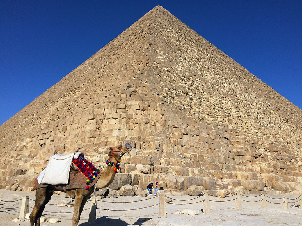
A camel poses in front of the Great Pyramid.

To see something in person that you’ve only seen in photos can be a surreal experience, especially something as iconic as the Great Pyramid of Giza. The last remaining Wonder of the Ancient World rises like a mountain from the flat desert west of the Nile River. The glimpses caught through the tall apartment buildings that clutter the modern skyline are just a tease of the main attraction.

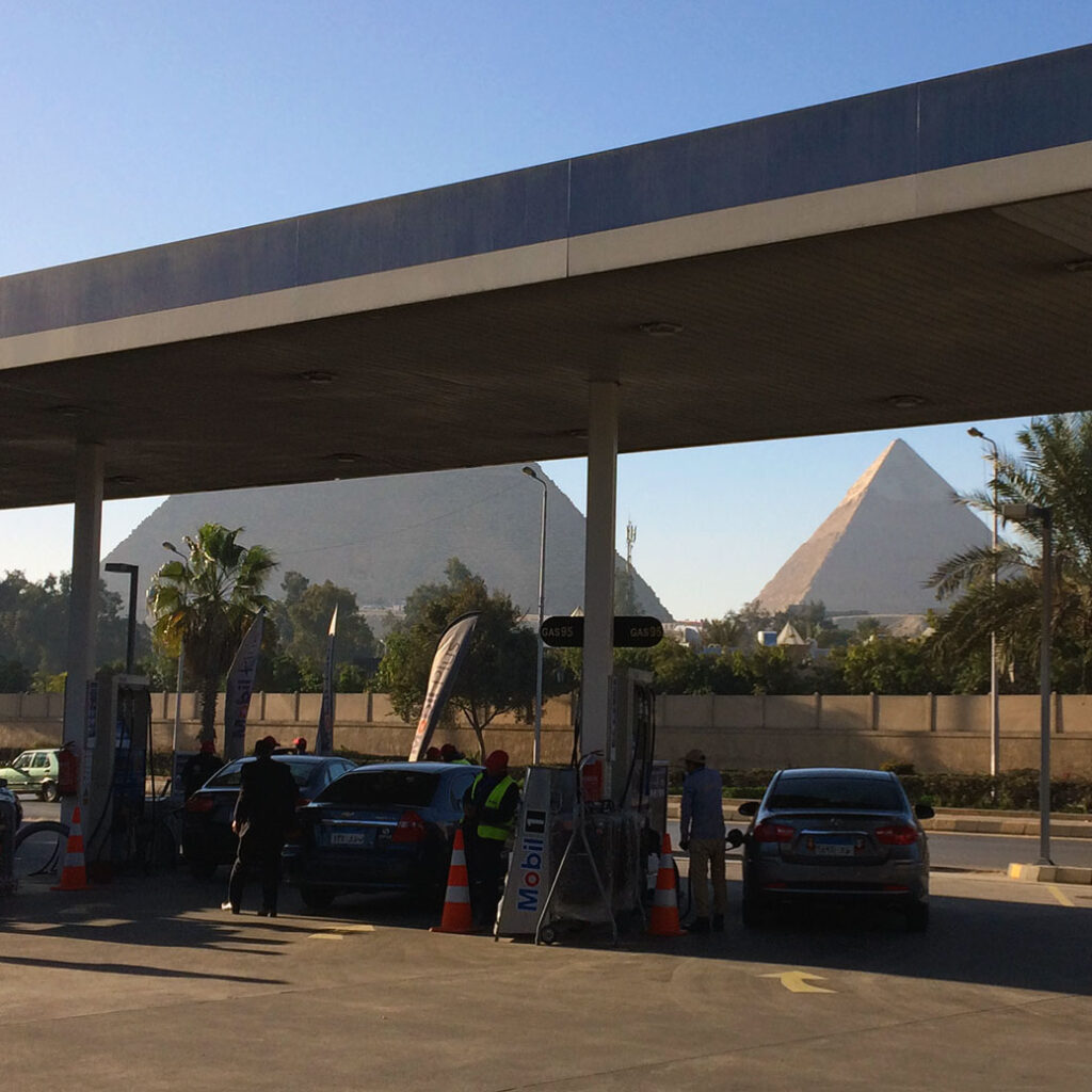
Our first up-close glimpse of the Pyramids came from a gas station... pretty good view while filling up the tank.
Our first up-close glimpse of the Pyramids came from a gas station… pretty good view while filling up the tank.

As we drove from Cairo toward Giza, it struck me how much the city encroaches on the plateau. The pyramids are typically photographed toward the west with the desert in the background. But just across the highway, the city has a front row seat to Ancient Egypt. So perhaps it’s fitting the roof of the On The Run gas station obstructed my first up-close view of the Pyramids.

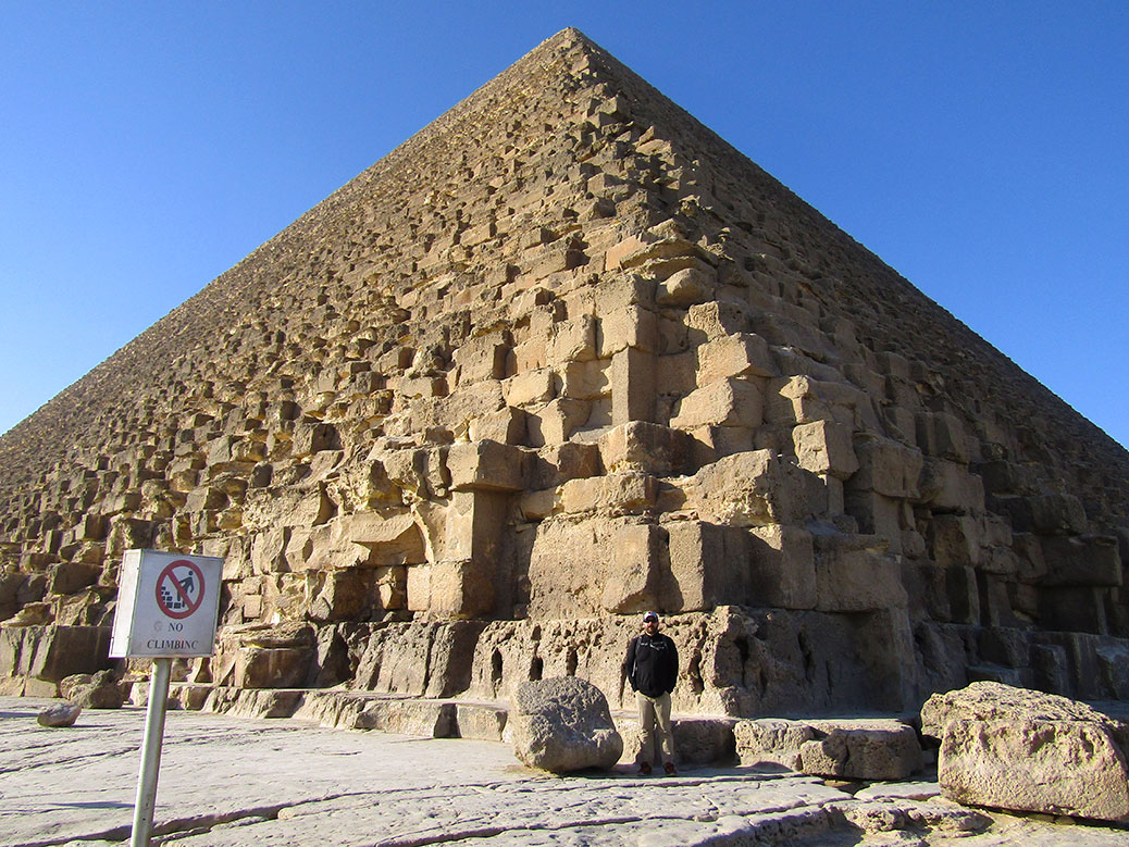
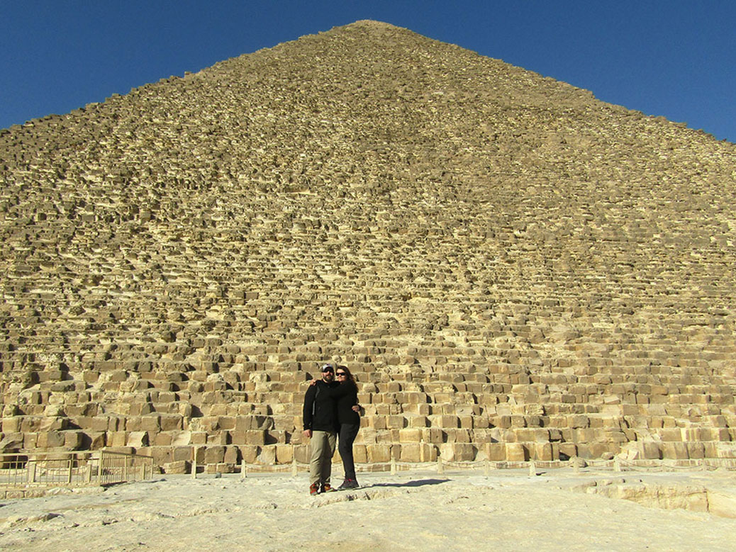
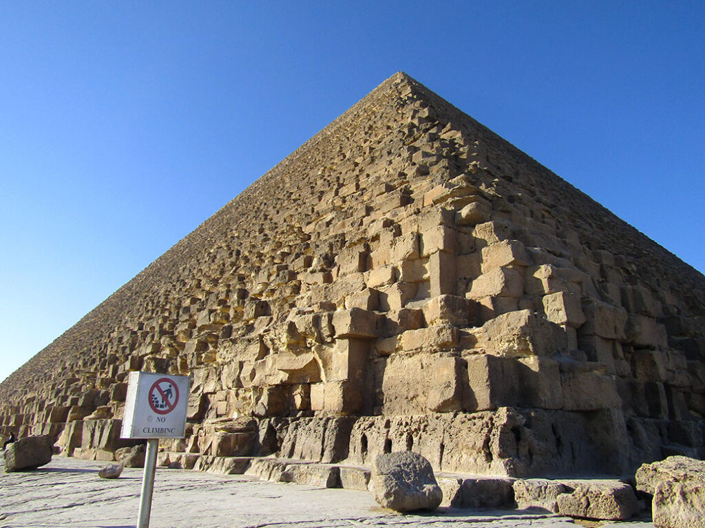
The Great Pyramid of King Khufu. From a distance, the pyramids seem smooth, but up close you can see the jagged exposed limestone of the pyramid's core.
The Great Pyramid of King Khufu. From a distance, the pyramids seem smooth, but up close you can see the jagged exposed limestone of the pyramid’s core.

Only a moment later, we left modern-day Egypt behind. From a distance, the pyramids are smooth, three-dimensional triangles, but up-close, you get a sense of how they were born. More than 2 million stone blocks, each weighing more than two tons create a craggy surface. Once covered in white sandstone—some of which can still be seen atop the middle pyramid—the exposed core tells a story of the construction.

Thought to have been built by slaves, it’s now known that the pyramids were built by skilled laborers, revered and honored for their work in the form of statues found during excavations. Construction techniques still used today were applied here in 2500 B.C. Stones sit flush with perfectly-flat surfaces. Corner joints allow for heat expansion and movement during earthquakes.

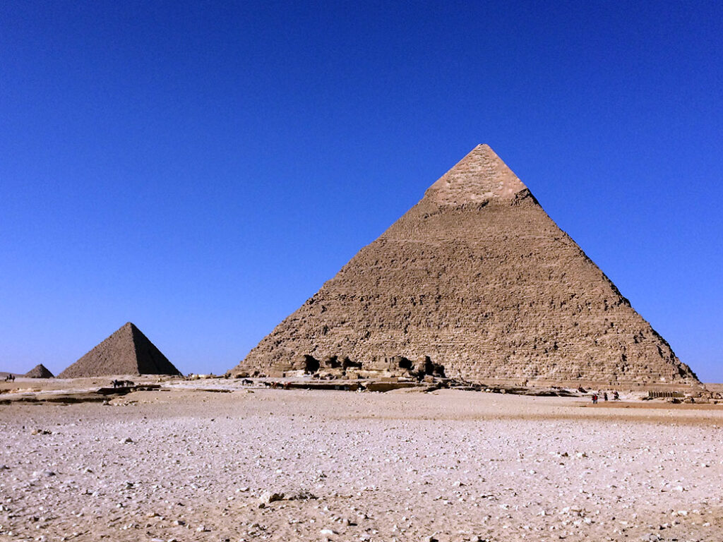
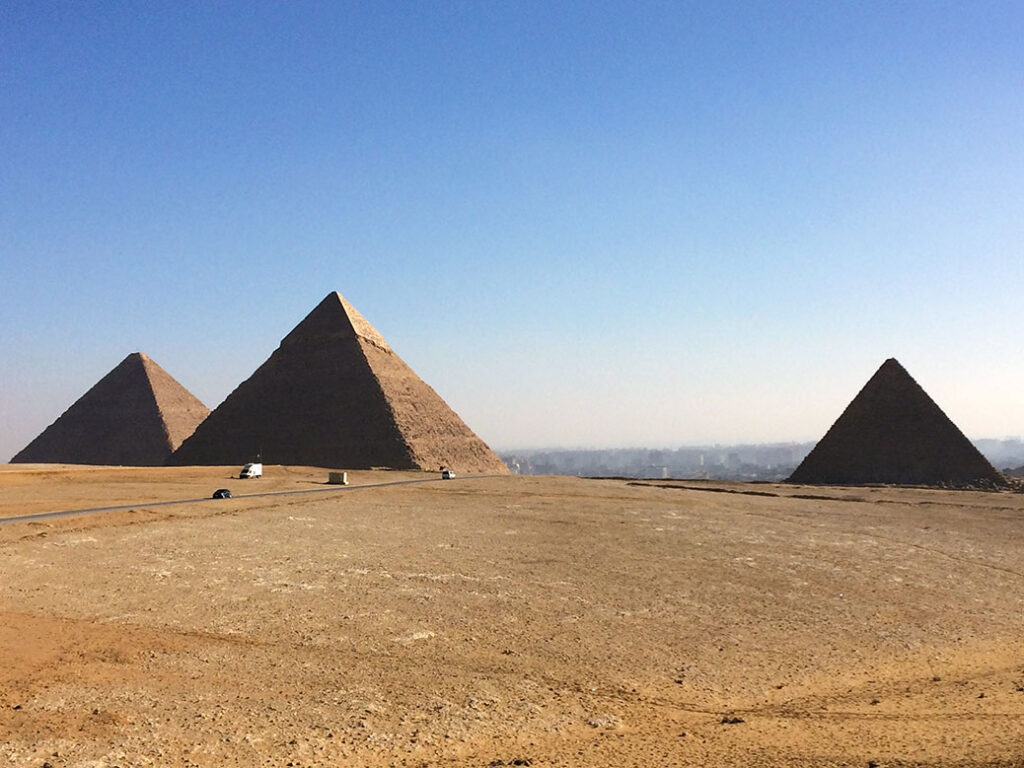
Khafre's Pyramid and Menkaure's Pyramid. In the distance, a smaller pyramid belonging to one of Khufu's wives can be seen.
Khafre’s Pyramid and Menkaure’s Pyramid. In the distance, a smaller pyramid belonging to one of Khufu’s wives can be seen.

Pharaoh Khufu commissioned the three main pyramids of the Giza Pyramid Complex in the 26th century B.C. The Great Pyramid, the largest structure on Earth until the 1300s, is built in his honor. The middle pyramid—which appears largest because of its higher perch—is named for Khufu’s son and successor Khafre. The third and smallest pyramid belongs to Khafre’s son and successor, Menkaura.

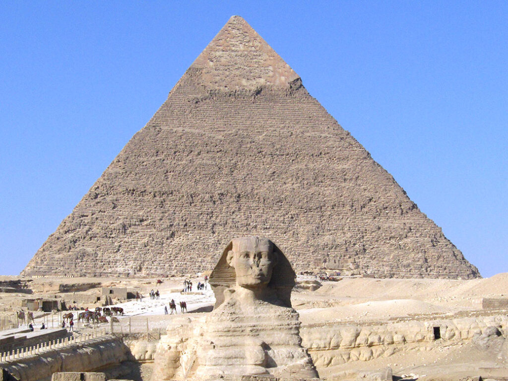
The Great Sphinx and Khafre's Pyramid at the Giza Pyramid Complex.
The Great Sphinx and Khafre’s Pyramid at the Giza Pyramid Complex.

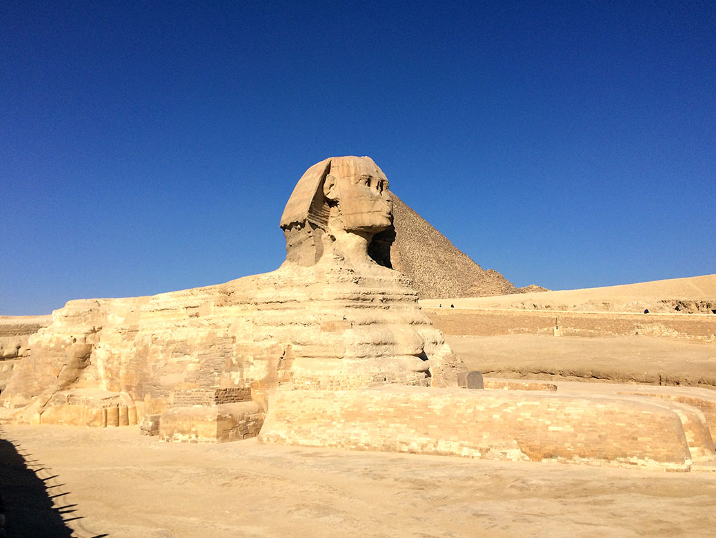
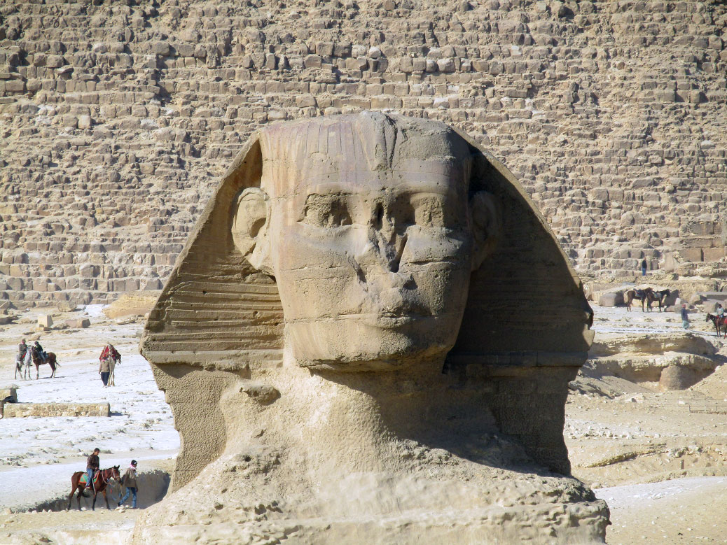
The Great Sphinx is part of Khafre’s pyramid complex. With the body of a lion and a head believed to depict Khafre, workers carved the famous statue out of the limestone from the quarry used to build the pyramids.

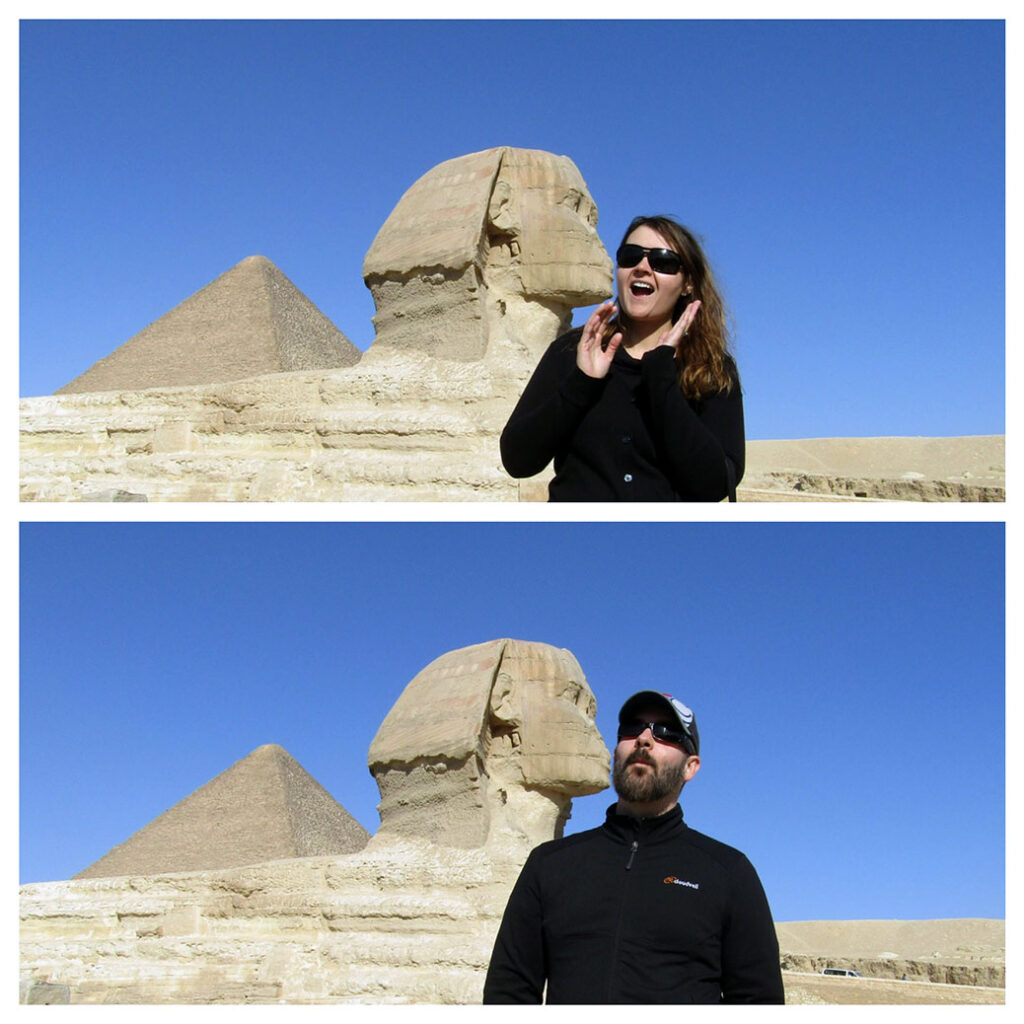
By all accounts, the Great Sphinx is a great kisser!

On the south side of the Sphinx, tourists gathered above the temple to pose for a variety of photos. The statue’s slightly puckered lips beg for a kissing photo. Not unlike Italy’s Leaning Tower of Pisa, part of the fun is watching visitors contort for the perfect picture.

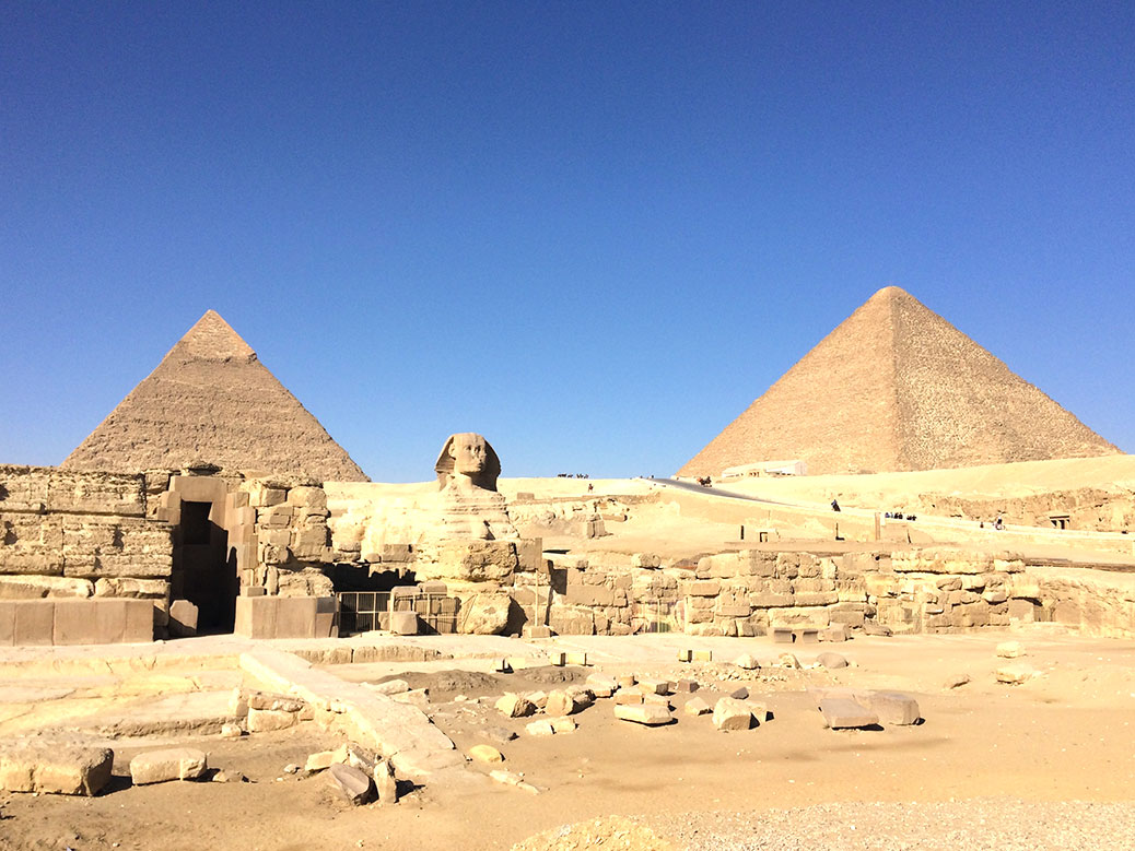
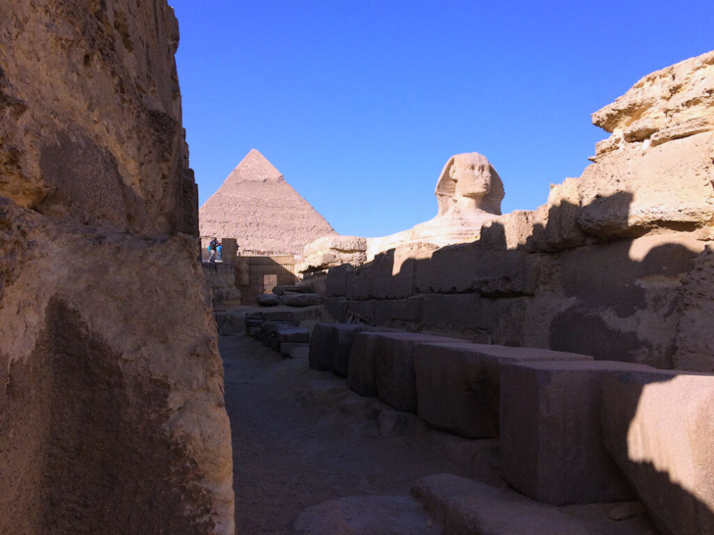
Coming around a corner near the entrance of the Sphinx Temple, the Great Sphinx and Khafre's Pyramid peeked through the ruins.
Coming around a corner near the entrance of the Sphinx Temple, the Great Sphinx and Khafre’s Pyramid peeked through the ruins.

Mohammed from Emo Tours served as our guide and site historian. He led us into the one of the sparsely populated temples where we caught a view of the Great Sphinx from below. With no other tourists around, it was a moment of solitude to really take in the experience.

View of the three main pyramids from a northwest viewpoint.

We ended our visit at a northwestern viewpoint, looking back toward the pyramids with Cairo in the background. The blend of the ancient and modern worlds made me wonder what the pharaohs would think of all this? Did they ever imagine visitors from far away lands making a pilgrimage to this place? Or that their legacy would outlive nearly everything else from their time, to tell their story for generations to come?

If You Go

Emo Tours
Guided tours of Egypt’s top sightseeing locations and highly-rated on TripAdvisor.

Alexandria, Egypt

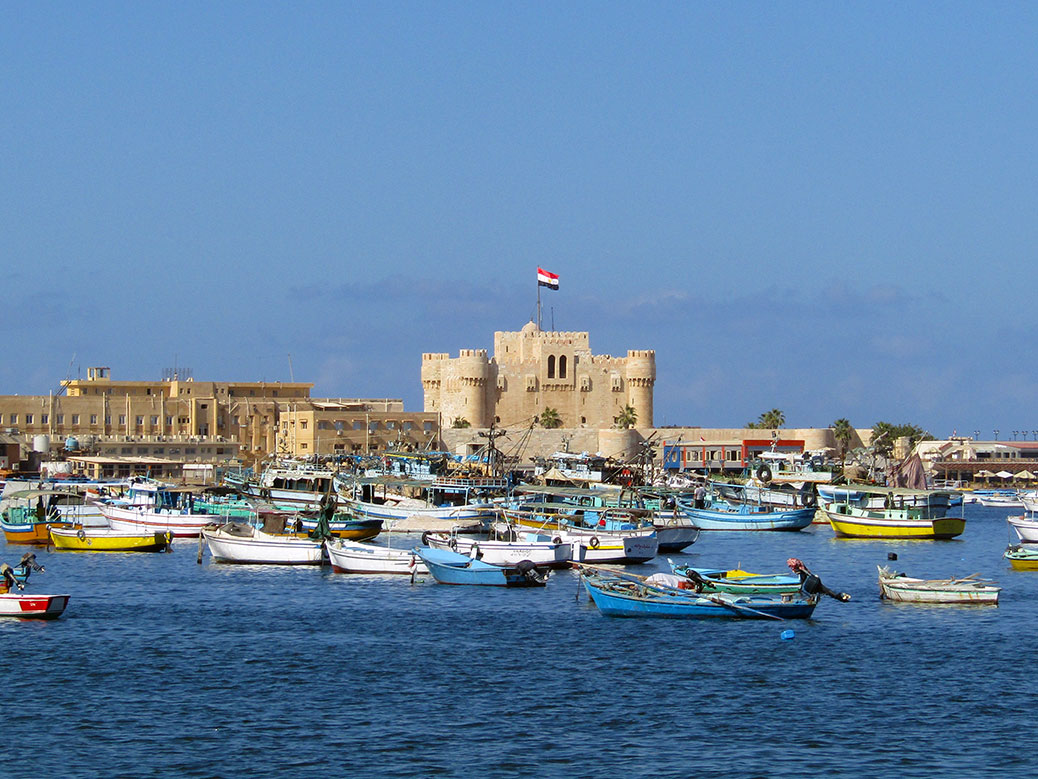
View of the Qaitbay Citadel on Alexandria’s Mediterranean coast.

Last weekend, I was fortunate to have time to take a day trip to Alexandria. Alexandria is north of Cairo and lies on the Mediterranean Sea, where the Nile River spreads out and drains into the sea. I learned in the Nile felucca post that the Nile runs south to north—which defies my logic!

The interesting thing about Alexandria is that it was founded by the Greek Alexander the Great so the Greco Roman influence is felt in the architecture, ruins and religion. It’s where Cleopatra courted Julius Caesar and later ruled fawith Mark Antony (now that is #goals). The sunny blue skies, white washed buildings and colorful boats gave more of an Athens than Cairo feel. I was elated by fresh sea air and blue skies!

Are we still in Egypt? The slanted building to the right is the Bibliotheca Alexandrina.

Robert had a discount code from winning a photo contest with Urban Adventures so I used it for their day tour of Alexandria. Urban Adventures tagline is ‘Best. Day. Ever.’ And it really was. The drive time to Alexandria from Cairo is about three hours, give or take an hour depending on traffic.

Blue skies and palm trees in Alexandria. And it wouldn’t be Egypt without a couple of minarets!

We started at the city’s Kom el Shoqafa catacombs; I didn’t know it was one of the Seven Wonders of the Middle Ages. It was discovered in the modern age of 1900 when a donkey almost fell down one of its air shafts. The catacombs were the city’s underground burial place for humble residents and honored royals alike. When I first heard “catacombs,” my mild claustrophobia kicked in with visions of long, dark tunnels and skulls. Thankfully, the tombs were well lit with plenty of headroom and oxygen.

The artwork on the main familial tomb had both Greek influenced art—after viewing the drawings inside in the Sakkara tombs, I could see the difference. Greek art is more rounded and freestyled while Egyptian is more angular and uniform. Our guide said that if Egyptian artists had painted pyramid tombs as carelessly as the Greeks they would be fired!

Greek style art in the main burial chamber of the catacombs.

Next, we passed by the Romans ruins of an amphitheater, which again, made me question where we were. The ruins were only discovered in 1960, accidentally again. They were purportedly used as a meeting or lecture hall.

The Roman Amphitheater in Alexandria.

After lunch, we started exploring my favorite part of the city, which is the corniche, or waterfront area. It was gorgeous!

Click any photo in the gallery to see a larger version and start a slideshow view

Our little group started to scatter in all directions to take pictures. With the city to our left and the water and boats to our right, we strolled until we reached the Qaitbay Citadel.

The Modern Mosaic by Fort Qaitbay. Mosque and minarets are pictured on the bottom left. Beside, stand the gods Taweret and Ra.

This citadel is built upon the exact location of the original Alexandria Lighthouse (one of the Ancient Wonders of the World). The lighthouse used to be the tallest manmade structure in the world, which is amazing considering it was on a tiny island.

Click any photo in the gallery to see a larger version and start a slideshow view

It’s unfortunate that of the tourists who do come to Egypt, few make it to Alexandria. I’m lucky to have experienced it and I’m looking forward to my next trip!

It's Me!
It’s Me!

Look for an upcoming post about the Bibliotheca Alexandrina (Alexandria Library).

Seven Wonders: Columbia River Gorge

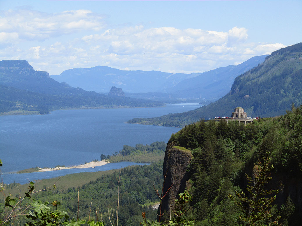
Looking east from the Portland Women's Forum State Scenic Viewpoint toward the Vista House on Crown Point and down the Columbia River Gorge.

Columbia River Gorge is the first in a series of posts on Cascadian Abroad focusing on the Seven Wonders of Oregon

Driving east on Interstate 84 from Portland, Ore. lies 80 miles of one of the most beautiful stretches of nature on the planet. Still largely undeveloped, the Columbia River Gorge is a playground for both locals and more than 3.5 million tourists annually.

The Gorge was formed over the course of 15 million years as the mighty Columbia River slowly eroded away the rock. Floods from the end of the Ice Age carved out the most dramatic features, exposing beautiful layers of volcanic rock. Looking at the Gorge today, with the river flowing strong some 4,000 feet below the top of the cliff walls, it’s a powerful image to imagine what it may have looked like as nature took its course.

On a recent sunny spring day, we headed for this natural wonderland, ultimately bound for the small town of Hood River. It didn’t take long to ditch the interstate for the more scenic Historic Columbia River Highway. The first planned scenic highway in the U.S., today’s HCRH runs for 40 miles through the forest, offering a gateway to many of the 90 waterfalls along the Oregon side of the Gorge.

Looking east down the Columbia River Gorge toward the Vista House on Crown Point.
Looking east from the Portland Women’s Forum State Scenic Viewpoint toward the Vista House on Crown Point and down the Columbia River Gorge.

Our first stop was the Portland Women’s Forum State Scenic Viewpoint, providing the most photographed view of the Columbia River Gorge. Just up the road, the Vista House at Crown Point unofficially marks the beginning of the Gorge. Built in 1916-18 as a resting area for the new highway, it now houses an excellent museum featuring the natural and human history of the Gorge.

Continuing east on the HCRH, rows of cars begin to appear on the shoulder of the narrow two-lane road. The waterfalls in this stretch—the most concentrated in all of North America—are the main draw for day-trippers from Portland looking to hike the scenic trails or just stop for photos or a picnic. Many of the falls are accessible by a short walk from the road or nearby parking lots.

Multnomah Falls is Oregon's tallest waterfall at an estimated 620 feet tall. It flows year-round, making it a popular tourist destination all year long.
Multnomah Falls is Oregon’s tallest waterfall at an estimated 620 feet tall. It flows year-round, making it a popular tourist destination all year long.

The biggest crowds are reserved for the magnificent Multnomah Falls. Oregon’s tallest waterfall drops in two parts—a long upper falls that collects into a basalt basin, giving way to a shorter lower falls. The best view is in front of the lower basin looking up at the footbridge, but a short walk up to the bridge is worthwhile.

Hiking to the top is a difficult march through steep switchbacks, but the views are worth it. You’ll also be rewarded with another waterfall—Little Multnomah—that can only be seen from the top.

From here, we followed the HCRH back to I-84 toward Hood River. Even on the modern freeway, there’s no shortage of sights along the way. The community of Bonneville is best known for the massive Bonneville Dam. Built in the 1930s as an initiative of the New Deal’s Public Works Administration, the dam provides power to more than 500,000 homes. It was named a National Historic Landmark in 1987.

Further up the river, the Bridge of the Gods crosses the Columbia River in the small city of Cascade Locks. The 90-year-old steel bridge gets its epic name from Klickitat tribe folklore, sharing its moniker with a land bridge created by a slide in 1100 A.D. The bridge also serves as the Columbia River crossing of the 2,659 mile-long Pacific Crest Trail, stretching from the Mexican border in California to the Canadian border in Washington.

Mt. Hood
The northeast face of Mt. Hood as seen from the Hood River Bridge.

We were ready to do some hiking of our own, although on a less grand scale than the PCT. Passing through Hood River, we quickly found ourselves at the payment window of the Hood River Toll Bridge without the requisite dollar for passage. A kind soul had left an extra dollar behind, covering our river crossing. On the way back—after a quick ATM stop—we left $2, one for our crossing and one to pay forward to the next forgetful traveler.

Click any photo in the gallery to see a larger version and start a slideshow view

Having safely forded the river, we continued east on the Washington side through the city of Bingen toward Catherine Creek. The Catherine Creek Trailhead offers something for everyone, from a short 1.2 mile walk through the Universal Access Trail (UAT) to a long, hilly 8.2 mile out-and-back to Coyote Wall.

Before we left for our two-year journey in Japan, we’d hiked the West Loop trail and its spectacular views of the Gorge and nearby Rowland Lake. This time, we opted for the two-mile Arch Loop hike, but first, we walked the loop around the UAT. The paved interpretive trail is packed with great views of the Gorge and Mt. Hood. Dozens of varieties of wildflowers bloom at different times of the year, always offering a punch of color. Benches offer places to rest and enjoy the scenery and the entire trail is wheelchair-accessible.

An abandoned corral along the Catherine Creek Arch Loop trail.

After our warmup, we headed out the stone and gravel path toward the Arch Loop trail. The easy trail has a bit of incline as it winds through the light forest, across Catherine Creek and between tall stone cliffs. Opposite an abandoned corral is the trail’s namesake arch rock. The area is fenced off as it is a sacred area for the local Native American tribes.

View of Mt. Hood and the Columbia River from the top of the Catherine Creek Arch Loop trail.

We followed the trail up to the top of the arch rock where views of Mt. Hood and the Gorge fill the skyline. The flatlands at the top offer a great opportunity to explore or just sit and enjoy the views. Eventually, we left the vista behind, following the edge of the cliff until the trail picked up again. The last stretch was a bit underwhelming as we made our way down onto the highway for the final quarter-mile, but overall, Catherine Creek is an enjoyable stroll.

We crossed back to Oregon and headed into Hood River for a stop at one of our favorite breweries. Full Sail Brewing is the largest, yet still maintains a local feel at its brewery and taproom overlooking the Columbia River. Full Sail’s simple flagship beers are widely available, but it’s here in Hood River where the mastery of the craft really shines with a variety of seasonals and Brewmaster Reserve recipes always on tap.

After enjoying the seasonal sampler, we took a walk around the downtown area. Although quiet on the weekday evening, the charming and easily-walkable downtown is lively on the weekends with great local restaurants and shops.  We finished up with one last pint and a pizza at Double Mountain Brewery before heading back toward Portland.

Sunset over the Columbia River
Sunset over the Columbia River.

Perhaps the only view more stunning than the eastern vista on a sunny day is the western view on a clear evening. The sun began to set as we approached the viewpoint near the historical marker commemorating the British explorers of the H.M.S. Chatham in the 1790s. The fiery sky reflected off the calm waters of the river, slowly gradating to the indigo of the evening. A perfect ending to a great day in the Columbia River Gorge.

If You Go…

Portland Women’s Forum State Scenic Viewpoint
From I-84 E, take exit 22 and follow Corbett Hill Rd to the Historic Columbia River Highway.

Vista House at Crown Point
Follow the Historic Columbia River Highway east from the Portland Women’s Forum State Scenic Viewpoint.

Multnomah Falls
Follow the Historic Columbia River Highway east from Crown Point or take I-84 E to exit 31 (left-hand exit) for the Multnomah Falls parking lot.

Catherine Creek Trailhead
From I-84 E, take exit 64 near Hood River and turn left for Button Bridge Rd. Cross the toll bridge ($1 each way for most vehicles) and turn right on WA-14. Just before Rowland Lake, turn left onto Old Highway 8 to the trailhead parking.

Full Sail Brewing
506 Columbia St, Hood River. Open daily from 11 a.m.-9 p.m.

Double Mountain Brewery
8 4th St, Hood River. Open daily from 11 a.m.-10 p.m.